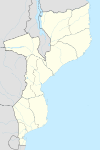
Palma, Mozambique
Appearance
Palma | |
|---|---|
| Coordinates: 10°47′S 40°29′E / 10.783°S 40.483°E | |
| Country | |
| Provinces | Cabo Delgado Province |
| District | Palma District |
| Time zone | UTC+2 (Central Africa Time) |
Palma is a town on the northeast coast of Mozambique, lying south of the border with Tanzania. It is known for basketry, for rugmaking and for its offshore islands. It is likely that Palma will become the base of LNG (liquefied natural gas) operations for the fast evolving offshore Mozambique natural gas industry.
An armed group of Islamist extremist rebels attacked Palma on March 24, 2021, resulting in more than 35,000 people being displaced.[a][2][3]
References
- ^ Christina Goldbaum; Eric Schmitt; Declan Walsh (28 March 2021). "As Militants Seize Mozambique Gas Hub, a Dash for Safety Turns Deadly". New York Times. Retrieved 29 March 2021.
- ^ "Armed groups attack Mozambique town closest to gas projects: sources". news.yahoo.com. Reuters. March 24, 2021. Retrieved March 24, 2021.
- ^ Bariyo, Nicholas; Steinhauser, Gabriele; Faucon, Benoit (March 27, 2021). "As Islamist Siege in Mozambique Drags On, Natural Gas Project Scrambles to Evacuate". The Wall Street Journal. Retrieved March 28, 2021.
Notes
- ^ The exact attackers are unknown. While News24 stated that the Islamic State of Iraq and the Levant took credit for the operation, The New York Times clarified on 28 March 2021 that ISIL had not yet "claimed responsibility for the strike in Palma".[1]
10°47′S 40°29′E / 10.783°S 40.483°E

