Les Clayes-sous-Bois
Les Clayes-sous-Bois | |
|---|---|
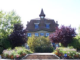
 The town hall in Les Clayes-sous-Bois | |
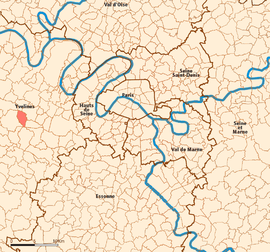
 Location (in red) within Paris inner and outer suburbs | |
| Coordinates: 48°49′00″N 1°59′00″E / 48.8167°N 1.9833°E | |
| Country | France |
| Region | Île-de-France |
| Department | Yvelines |
| Arrondissement | Versailles |
| Canton | Plaisir |
| Intercommunality | Saint-Quentin-en-Yvelines |
| Government | |
| • Mayor (2020–2026) | Philippe Guiguen |
Area 1 | 6.11 km2 (2.36 sq mi) |
| Population (2021)[1] | 17,237 |
| • Density | 2,800/km2 (7,300/sq mi) |
| Time zone | UTC+01:00 (CET) |
| • Summer (DST) | UTC+02:00 (CEST) |
| INSEE/Postal code | 78165 /78340 |
| 1 French Land Register data, which excludes lakes, ponds, glaciers > 1 km2 (0.386 sq mi or 247 acres) and river estuaries. | |
Les Clayes-sous-Bois is a commune in the Yvelines department in the Île-de-France region in north-central France. It is located in the western suburbs of Paris 26.7 km (16.6 mi) from the center. The Clayes-sous-Bois inhabitants are called "Clétiens" (possibly translated "Cletians").


Geography
The commune of Les Clayes-sous-Bois is located approximately 14 km of Versailles and 30 km of Paris, in the southwest of the Versailles plain. The commune is highly urbanized, with mostly single-family housing, except for the southern part of the commune, which is covered by a part of the Bois-d'Arcy forest.
It borders the cities of Chavenay , Villepreux, Bois-d'Arcy, Trappes to and Plaisir.
Culture, places and remarkable sites
St Martin Church: the oldest building in the town. Its nave is from the 11th century, the choir and the sanctuary were built during 14th and 15th centuries. The church has Roman and Gothic elements all over its structure. The original bell-tower was destroyed during the Hundred Years' War. It was rebuilt decades afterward. The religious building was devoted to St Martin of Tours under the rule of King Henry III in the 16th century. During the Second World War, the church was partly destroyed by bombs. In 1949, it was fixed and restored by the Mayor's office.
Castle: Several castles were built in the commune. Nowadays, only two bare towers remain in the Park of Diane (King Henry II's favourite), vestiges of the castle of the Delaborne House in the XIXth Century.
The Park of Diane: this location is registered at the cultural office since 2003. The main element is the famous Arbre de Diane (Tree of Diane), which was seeded in 1556 by (or for?) Diane of Poitiers, lover of the King Henry II.
History
Prehistory
Prehistoric elements such as carved axes and bronze bracelets have been discovered on the site of Les Clayes and are now exhibited in the national archaeology museum of Saint-Germain-en-Laye, testifying its occupation since prehistoric times.
Middle Ages
A stone path, of which there are still vestiges, passed through the village. It is nowadays the "Chemin aux Bœufs" ( the Oxen Road) . As its name indicates, this secondary road was used for cattle transport from Normandy; the animals were then inspected in Chavenay and put on sale at the Poissy and Saint-Germain-en-Laye markets .
In the Middle Ages, the partition of the territory of the old Roman Empire began, giving rise to fiefdoms ruled by lords; in exchange for the protection of the latter, the peasants could cultivate their lands in security.
At the beginning of the 12th century, the lands of Clais (old name of the city) belonged to Simon de Cloyes. In 1118, he had a castle built near the church. The church was built on the upper part of the village under the reign of Philip I . Excavations carried out in 1875 during the construction of the enclosing wall of the Saint-Martin cemetery revealed a forgotten cellar that belonged to the castle. In 1160, the bishop of Chartres, Robert III, assign the parish of Les Clayes to the abbey of Saint-Cyr, which was confirmed by Pope Alexander III in a bull three years later.
Education
Preschools[2]
- André Briquet
- Paul Langevin
- La Bretechelle
- Henri Prou
- Le Chêne Sorcier
- René Coty
- Nouveau Cottage
Primary schools:[2]
- Marcel Pagnol
- Jean Jaurès
- Henri Prou
- Victor Hugo
- René Coty
- Paul Eluard
The commune has two junior high schools: La Fosse aux Damnes and Anatole France. Lycée Jean-Vilar in Plaisir and Lycée Sonia Delaunay in Villepreux are nearby.[2]
Transport
Les Clayes-sous-Bois is served by Villepreux – Les Clayes station on the Transilien Paris – Montparnasse suburban rail line and by an efficient bus station that links the town to Versailles, Saint-Quentin-en-Yvelines and a few other communes around.
See also
References
- ^ "Populations légales 2021" (in French). The National Institute of Statistics and Economic Studies. 28 December 2023.
- ^ a b c "Etablissements scolaires." Les Clayes-sous-Bois. Retrieved on September 3, 2016.
External links
- Home page (in French)


