Kurd Mountain
This article needs additional citations for verification. (June 2017) |
| Kurd Mountains | |
|---|---|
| Kurd-Dagh | |
 Hills of the Kurd Mountains in Afrin | |
| Highest point | |
| Coordinates | 36°40′N 36°46′E / 36.667°N 36.767°E |
| Geography | |
| Location | |
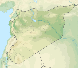
Kurd Mountains or Kurd-Dagh (Template:Lang-ku Çiyayê Kurmênc, Template:Lang-tr), Template:Lang-ar) is a highland region in northwestern Syria and southeastern Turkey. It is located in the Aleppo Governorate of Syria and Kilis Province of Turkey. The Kurd mountain should not be confused with the neighboring Jabal al Akrad (Kurds' mountain) which is located further southwest towards the mediterranean coastline.
Location and description
Kurd Mountains are part of the Limestone Massif of northwestern Syria. The mountains are a southern continuation into the Aleppo plateau of the highlands on the western part of the Aintab plateau. The valley of River Afrin surrounds Kurd Mountains from east and south and separates it from the plain of Aʻzāz and Mount Simeon to the east, and from Mount Harim to the south. The valley of River Aswad separates Mount Kurd from Mount Amanus to the west.
In Syria, it is among the four "ethnic mountains" of western Syria, along with al-Ansariyah mountains ("Mountain of the Alawites"), Jabal Turkman ("Mountain of the Turkmens") and Jabal al-Duruz ("Mountain of the Druze").
The main town is Afrin (Efrîn in Kurdish), in Syria. The area is known for its olive growing and charcoal production. The majority of the Kurd-Dagh population are Hanafi-Muslims, while most Syrian Kurds are Shafiite-Muslims. Yazidis also have a presence in the region.[1]
The Sherefname (1592) asserts that the authority of Kurdish beys of the region was extended to localities in Antakya. In areas in the plains such as Islahiye, Kırıkhan, Reyhanlı, and Kilis, there are vestiges of Kurdish concentration in Kurd-Dagh.
Demographics
As the Kurd Dagh was governed by the French, several Kurdish tribes were living in the area.[2] From the 1800s onwards, there have settled several Kurds from the Kurd Dagh to Aleppo.[3] In the 1930s, Kurdish Alevis who fled the persecution of the Turkish Army during the Dersim Massacre, settled in Mabeta.[4]
While other regions populated by Kurds in Syria faced an influx of Arab immigrants and the campaign of Arabization beginning in 1960s, Kurd-Dagh was spared from Arabization, mainly due to Syria's different policy based upon good relations with pro-Damascus landowners.[citation needed]
Etymology
In 1977 the Kurd Dagh was renamed into the Arabic Jabal al-`Uruba in accordance with decree 15801 which banned non-arabic place names.[5]
The Turkish part was renamed officially as Kurt Dağı ("Wolf Mountain"), with a pun on the Turkish words Kürt (Kurd) and kurt (wolf). In the Syrian part during the 1980s the Kurdish names of most of this region's villages were changed to Arabic as part of the process of Arabization.
See also
References
- ^ Açikyildiz, Birgül (23 December 2014). The Yezidis: The History of a Community, Culture and Religion. London, UK: I.B. Tauris. p. 63. ISBN 1848852746.
- ^ Tejel, Jordi (2008-08-29). Syria's Kurds: History, Politics and Society. Routledge. p. 9. ISBN 978-1-134-09643-5.
- ^ Tejel, Jordi (2008-08-29). Syria's Kurds: History, Politics and Society. Routledge. p. 11. ISBN 978-1-134-09643-5.
- ^ "derStandard.at". DER STANDARD.
- ^ "State policies and military actions continue to threaten further displacement" (PDF). Relief Web. p. 7. Retrieved 20 July 2020.
External links

