Elgi Plateau
| Elgi Plateau | |
|---|---|
| Эльгинское плоскогорье | |
| Highest point | |
| Peak | Tuoydakh Peak |
| Elevation | 3,003 m (9,852 ft) |
| Dimensions | |
| Length | 1,100 km (680 mi) |
| Width | 1,050 km (650 mi) |
| Area | 1,155,000 km2 (446,000 sq mi) |
| Geography | |
| Country | Russia |
| Federal subject | Sakha |
| Range coordinates | 64°40′N 139°0′E / 64.667°N 139.000°E |
| Parent range | Yana-Oymyakon Highlands East Siberian System |
| Geology | |
| Rock age | Proterozoic |
| Rock type(s) | Sandstone, siltstone[1] |
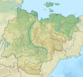
The Elgi Plateau (Russian: Эльгинское плоскогорье)[2] is a plateau in the Sakha Republic, Far Eastern Federal District, Russian Federation.
The area is named after the Elgi River.
Geography
The Elgi Plateau covers the central Yana-Oymyakon Highlands, in the upper Elgi and Delinya River basins. The plateau is bound by the Verkhoyansk Range to the west and the Chersky Range to the northeast, the Yana Plateau to the northwest, the Suntar-Khayata Range to the southwest and the Oymyakon Plateau to the southeast.[3]
The average height of the plateau surface is between 1,200 meters (3,900 ft) and 1,400 meters (4,600 ft). Dome-shaped peaks rise between the interfluves and the highest point is 1,590 metres (5,220 ft) high Tuoydakh Peak.[4]
Flora
Forests of larch taiga generally cover the flat areas and lower slopes, and in the higher elevations Siberian pine, giving way to alpine tundra in the mountaintops. Willows and poplars may grow in the floodplains of the intermontane basins.[1]
References
- ^ a b Эльгинское плоскогорье, Great Soviet Encyclopedia
- ^ Soviet General Topographic Maps P-54-V,VI
- ^ Geographical Atlas of Russia. - Federal Agency for Geodesy and Cartography , AST, 2010. - pp. 118-119
- ^ Google Earth

