Jump to content

List of beaches in Barbados

From Wikipedia, the free encyclopedia

This is an old revision of this page, as edited by G. Moore (talk | contribs) at 19:02, 19 September 2021 (Beaches: add coord and ref). The present address (URL) is a permanent link to this revision, which may differ significantly from the current revision.

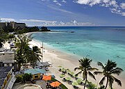
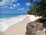
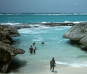
Miami Beach, Barbados

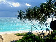
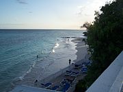
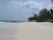
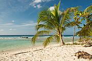
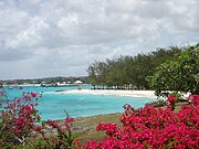
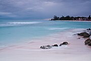
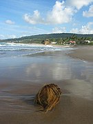
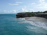
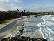
The island country of Barbados has more than 70 miles (110 km) of beaches of both pink and white sands, which are made of coral reefs that have been ground into a very fine powder by the waves of the ocean. Beaches on Barbados can be categorized by region: north and east coast beaches, south coast beaches, and west coast beaches. East and north coast beaches are facing the Atlantic Ocean, while the waters of the southern beaches are a combination of both the Atlantic Ocean and Caribbean Sea. The west coast, or the Platinum Coast, beaches are brimmed by the warm waters of the Caribbean. This is a list of many of the beaches located in Barbados. There are no private beaches on the island.[1][2][3][4]


Beaches

There are 61 beaches in Barbados, including the following with the parishes indicated for each beach:

Selected beaches in Barbados
Beach Parish Coor/Refs
Accra Beach Christ Church 13°04′00″N 59°33′42″W / 13.0667°N 59.5616°W / 13.0667; -59.5616 (Accra Beach)[1]
Alleyne Beach Saint James 13°12′24″N 59°38′29″W / 13.20672174292628°N 59.641524581338°W / 13.20672174292628; -59.641524581338 (Alleyne Beach)[5]
Bathsheba Beach Saint Joseph 13°12′52″N 59°31′23″W / 13.214403995245824°N 59.523035321485274°W / 13.214403995245824; -59.523035321485274 (Bathsheba Beach)[1][5]
Bath Beach Saint John 13°11′15″N 59°28′36″W / 13.187601458423346°N 59.476694683921366°W / 13.187601458423346; -59.476694683921366 (Bath Beach)[1][5]
Batts Rock Saint Miachael 13°08′07″N 59°38′11″W / 13.135363516178536°N 59.636399918494575°W / 13.135363516178536; -59.636399918494575 (Batts Rock Beach)[1][5]
Bottom Bay beach Saint Philip 13°08′10″N 59°25′28″W / 13.13622°N 59.42437°W / 13.13622; -59.42437 (Bottom Bay)[1][5]
Brandons Beach Saint Michael 13°06′57″N 59°37′38″W / 13.11590595737466°N 59.62735172040175°W / 13.11590595737466; -59.62735172040175 (Brandons Beach)[1][5]
Brighton Beach Saint Michael 13°07′20″N 59°37′52″W / 13.12229021846367°N 59.63112300685849°W / 13.12229021846367; -59.63112300685849 (Brighton Beach)[1][5]
Brownes Beach Saint Michael 13°05′10″N 59°36′35″W / 13.086059277329028°N 59.609783323858785°W / 13.086059277329028; -59.609783323858785 (Brownes Beach)[1][5]
Carlisle Bay Saint Michael [1]
Casuarina Beach Christ Church [6]
Cattlewash Saint Joseph 13°13′21″N 59°31′55″W / 13.222482858788487°N 59.532026162034384°W / 13.222482858788487; -59.532026162034384 (Cattlewash Beach)[1][5]
The Chase Beach Saint Andrew 13°16′28″N 59°34′00″W / 13.27457°N 59.56669°W / 13.27457; -59.56669 (The Chase Beach)[2]
Crane Beach Saint Philip 13°06′24″N 59°26′38″W / 13.10659°N 59.4438°W / 13.10659; -59.4438 (Crane Beach)[2][1]
Dover Beach Christ Church 13°04′00″N 59°34′10″W / 13.0666°N 59.56957°W / 13.0666; -59.56957 (Dover Beach)[2][1]
Freshwater Bay Saint Michael 13°07′50″N 59°38′09″W / 13.13062°N 59.63572°W / 13.13062; -59.63572 (Freshwater Bay)[7][8]
Heywoods Beach Saint Peter 13°15′25″N 59°38′39″W / 13.257°N 59.64423°W / 13.257; -59.64423 (Heywoods Beach)[2][1][5]
Garrison Beach Christ Church
Gibbes Beach Saint Peter 13°13′54″N 59°38′35″W / 13.231549909239018°N 59.64307898383843°W / 13.231549909239018; -59.64307898383843 (Gibbes Beach)[1]
Lakes Beach Saint Andrew 13°14′21″N 59°32′43″W / 13.23909°N 59.54523°W / 13.23909; -59.54523 (Lakes Beach)[2]
Little Bay Saint Lucy 13°18′36″N 59°34′44″W / 13.30989793016272°N 59.57901518636481°W / 13.30989793016272; -59.57901518636481 (Little Bay Beach)[1][5]
Miami Beach (aka Enterprise Beach) Christ Church 13°3′35″N 59°32′23″W / 13.05972°N 59.53972°W / 13.05972; -59.53972 (Miami Beach)[1]
Maxwell Beach Christ Church 13°04′00″N 59°33′00″W / 13.06667°N 59.55°W / 13.06667; -59.55 (Maxwell Beach)[2][1][5]
Morgan Lewis Beach Saint Andrew 13°16′10″N 59°33′51″W / 13.26936°N 59.56429°W / 13.26936; -59.56429 (Morgan Lewis Beach)[2][1]
Mullins Beach Saint Peter 13°14′04″N 59°38′34″W / 13.234398551717133°N 59.642671257110784°W / 13.234398551717133; -59.642671257110784 (Mullins Beach)[1][5]
Paradise Beach Saint Michael 13°07′49″N 59°38′05″W / 13.130360625871734°N 59.63479531689409°W / 13.130360625871734; -59.63479531689409 (Paradise Beach)[1][5]
Paynes Bay Saint Thomas 13°10′N 59°38′W / 13.167°N 59.633°W / 13.167; -59.633 (Paynes Bay)[1][5]
Pebbles Beach Saint Michael 13°05′14″N 59°36′35″W / 13.0873264579636°N 59.60976185851335°W / 13.0873264579636; -59.60976185851335 (Pebbles Beach)[1]
River Bay Saint Lucy 13°19′24″N 59°35′44″W / 13.32319624043607°N 59.5955167521675°W / 13.32319624043607; -59.5955167521675 (River Bay)[1][5]
Rockley Beach Christ Church 13°04′25″N 59°35′21″W / 13.07355°N 59.58925°W / 13.07355; -59.58925 (Rockley Beach)[2]
Shark's Hole Bay Saint Philip 13°07′13″N 59°26′01″W / 13.120325919884463°N 59.433621168494746°W / 13.120325919884463; -59.433621168494746 (Shark's Hole Bay)[1][5]
Silver Sands Beach Christ Church 13°02′50″N 59°31′03″W / 13.047294028166181°N 59.5173659317352°W / 13.047294028166181; -59.5173659317352 (Silver Sands Beach)[9]
Walkers Beach Saint Andrew 13°15′25″N 59°33′27″W / 13.25707°N 59.55755°W / 13.25707; -59.55755 (Walkers Beach)[2][1]
Welches Beach Christ Church 13°03′55″N 59°32′55″W / 13.06513921249477°N 59.5487277656792°W / 13.06513921249477; -59.5487277656792 (Welches Beach)[1][5]
Worthing Beach (aka Sandy Beach) Christ Church 13°04′16″N 59°34′59″W / 13.07118°N 59.58305°W / 13.07118; -59.58305 (Worthing Beach)[2][1]


See also

References

  1. ^ a b c d e f g h i j k l m n o p q r s t u v w x y z aa ab "Barbados Beaches". Fun Barbados. Retrieved September 19, 2021.
  2. ^ a b c d e f g h i j k "Beaches in Barbados". GeoNames. Retrieved September 19, 2021.
  3. ^ "All Barbados Beaches". Totally Barbados. Retrieved September 19, 2021.
  4. ^ Welch, Nick. "Beaches of Barbados - interactive map". Beaches of Barbados. Retrieved September 19, 2021.
  5. ^ a b c d e f g h i j k l m n o p q r Google maps
  6. ^ Possibly closed beach, no references
  7. ^ "Freshwater Bay". GeoNames. Retrieved September 19, 2021.
  8. ^ Moxly, Joseph Henry Sutton (1886). An Account of a West Indian Sanatorium and a Guide to Barbados. S. Low, Marston, Searle, & Rivington. pp. 60-61. Freshwater Bay Barbados.
  9. ^ "Silver Sands Beach". Visit Barbados. Retrieved September 19, 2021.