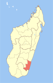
Atsimo-Atsinanana
Appearance
Atsimo-Atsinanana Region | |
|---|---|
Region | |
 Location in Madagascar | |
| Country | |
| Capital | Farafangana |
| Government | |
| • Gouvenor | Justin Mahafaky |
| Area | |
• Total | 18,863 km2 (7,283 sq mi) |
| Population (2018)[2] | |
• Total | 1,026,674 |
| • Density | 54/km2 (140/sq mi) |
| Time zone | UTC3 (EAT) |
| HDI (2018) | 0.418[3] low · 21st of 22 |
Atsimo-Atsinanana (South East) is a region in Madagascar. Its capital is Farafangana. The region used to be part of the Fianarantsoa Province.
The region extends along the southern part of the east coast of Madagascar. It is bordered by Vatovavy-Fitovinany and Haute Matsiatra (North), Ihorombe (West) and Anosy (South).
The population was 1,026,674 in 2018.[2] It is among the poorest regions in the country, with a poverty rate of 83.9% according to a 2005 government report.[4]
Administrative divisions
Atsimo-Atsinanana Region is divided into five districts, which are sub-divided into 90 communes.[5]
- Befotaka Sud District - 6 communes
- Farafangana District - 30 communes
- Midongy-Atsimo District - 6 communes
- Vangaindrano District - 28 communes
- Vondrozo District - 16 communes
Transport
Airports
Protected Areas
- Part of Fandriana-Vondrozo Corridor
- Agnakatrika New Protected Area
- Agnalazaha New Protected Area
- Ankarabolava New Protected Area
- Midongy Atsimo National Park
- Manombo Reserve
See also
References
- ^ EBDM
- ^ a b "Troisieme Recensement General de la Population et de L'Habitation (RGPH-3) Resultats Provisoires" (PDF). Institut National de la Statistique Madagascar. Retrieved May 23, 2020.
- ^ "Sub-national HDI - Area Database - Global Data Lab". hdi.globaldatalab.org. Retrieved 2018-09-13.
- ^ Republic of Madagascar: Poverty Reduction Strategy Paper Annual Progress Report, International Monetary Fund (August 2006) (IMF Country Report No. 06/303) (poverty data is from 2005 Periodic Household Survey conducted by the Institut National de la Statistique de Madagascar (INSTAT))
- ^ Rapport de mise en oeuvre des Priorites Regionales - Region Atsimo Atsinanana[permanent dead link] (2010) (pdf includes district and commune map)

