Am Dam
Appearance
Am Dam
أم دام | |
|---|---|
| Coordinates: 12°45′44″N 20°28′13″E / 12.76222°N 20.47028°E | |
| Country | |
| Region | Ouaddaï Region |
| Department | Djourf Al Ahmar |
| Sub-Prefecture | Am Dam |
| Elevation | 1,453 ft (443 m) |
| Time zone | + 1 |
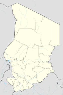
Am Dam (Template:Lang-ar) is the capital of Djourf Al Ahmar Department in Sila Region, Chad, located at an important crossroads in the Batha River valley. It is a small town about 120 km (75 mi) northwest of Goz-Beida and 700 km (430 mi) by road from the capital N'Djamena.[1] Am Dam is also the name of the Sub-Prefecture that the city is within. The population of the entire Am Dam Sub-Prefecture is 77,593.[2]
The town is served by Am Dam Airport.
History
It was captured by rebels in their advance on N'Djamena on June 15, 2008.[3] A battle near the town stopped a new rebel offensive in May 2009, with more than 200 reported deaths.[4]

