Raito (village)
Appearance
Raito | |
|---|---|
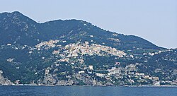
 Raito seen from the sea. In the left corner, upon the hill, the village of Albori | |
| Coordinates: 40°40′4.92″N 14°42′58.2″E / 40.6680333°N 14.716167°E | |
| Country | Italy |
| Region | |
| Province | Salerno (SA) |
| Comune | Vietri sul Mare |
| Elevation | 294 m (965 ft) |
| Population (2001)[1] | |
• Total | 996 |
| Demonym | Raitesi |
| Time zone | UTC+1 (CET) |
| • Summer (DST) | UTC+2 (CEST) |
| Postal code | 84019 |
| Dialing code | (+39) 089 |
| Patron saint | Our Lady of Graces |
| Website | Official website |
Raito is an Italian hamlet (frazione) of the municipality of Vietri sul Mare in the Province of Salerno, Campania. It is part of the Amalfi Coast and its population is 996.[1]
Geography
[edit]Raito is located on a hillside under the Lattari Mountains and upon the Tyrrhenian Coast and the Amalfi Drive. It is located on a road linking Albori (1,1 km in the east) to Vietri sul Mare (2 km in the east), and is 6 km far from Cetara, 7 from Cava de' Tirreni, 7,5 from Salerno and 21 from Amalfi. Its inhabited area counts some scattered houses upon the coast and is close to the beach of Marina d'Albori.
Gallery
[edit]-
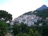
View of Raito
-
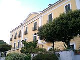
Villa Guariglia
Personalities
[edit]- Antonio Savastano (1948-1991): tenor, died in Raito in which he lived from 1980s
See also
[edit]References
[edit]- ^ a b (in Italian) Info at italia.indettaglio.it
External links
[edit]![]() Media related to Raito at Wikimedia Commons
Media related to Raito at Wikimedia Commons
- (in German and Italian) Raito website


