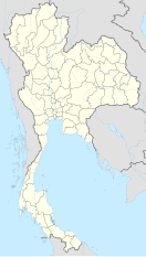
Nakhon Ratchasima Airport
Appearance
This article needs additional citations for verification. (November 2022) |
Nakhon Ratchasima Airport ท่าอากาศยานนครราชสีมา | |||||||||||
|---|---|---|---|---|---|---|---|---|---|---|---|
| Summary | |||||||||||
| Airport type | Public | ||||||||||
| Operator | Department of Airports | ||||||||||
| Serves | Nakhon Ratchasima | ||||||||||
| Location | Chaloem Phra Kiat, Nakhon Ratchasima | ||||||||||
| Opened | 5 December 1997 | ||||||||||
| Elevation AMSL | 765 ft / 233 m | ||||||||||
| Coordinates | 14°56′58″N 102°18′45″E / 14.94944°N 102.31250°E | ||||||||||
| Maps | |||||||||||
 | |||||||||||
 | |||||||||||
| Runways | |||||||||||
| |||||||||||
Nakhon Ratchasima Airport (Template:Lang-th) (IATA: NAK, ICAO: VTUQ), is a domestic airport serving Nakhon Ratchasima, Thailand.[1]
Nakhon Ratchasima airport is in Amphoe Chaloem Phra Kiat, approximately 26 kilometers east of the city of Nakhon Ratchasima.
Airlines and destinations
| Airlines | Destinations |
|---|---|
| Nok Air | Chiang Mai |
References
- ^ "(NAK) Nakhon Ratchasima Airport Overview". FlightStats. Retrieved 1 July 2015.
External links
 Nakhon Ratchasima travel guide from Wikivoyage


