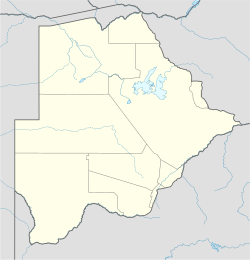
Goodhope, Botswana
Good Hope
Gudas | |
|---|---|
Village | |
| Coordinates: 25°28′1.64″S 25°26′21.17″E / 25.4671222°S 25.4392139°E | |
| Country | |
| District | Good Hope District (Botswana) |
| Government | |
| Population (2011) | |
• Total | 6,362 |
Good Hope is a village in the Good Hope District of Botswana. Originally called Gamokoto village, now a ward in Good Hope.The village is the capital of Barolong who are one of the major tribes in Botswana. It serves as the administrative center for the Good Hope District Council.
It is home to the Barolong farms, known for its large commercial arable fields. Barolong are ruled by Chief Lotlamoreng II Montshioa. The Barolong of the Tshidi.
Geography
Good Hope is located in the Southern District of Botswana.
GoodHope has a primary hospital, a clinic, a junior secondary school, a primary school and a police station. It is also home to the largest Senior School by capacity opened March 2008.[1]
Good Hope is approximately 57 km away from Kanye which is the capital of the Southern District.[2] Goodhope is approximately 102 km from Gaborone, the capital city of Botswana.
Population
The population was 6,362 in 2011 census.
Government
Good Hope is under the GoodHope-Mabule Constituency [3] represented by MP Eric Molale in the National Assembly.
References
- ^ "Botswana Central Statistics Office" (PDF). Archived from the original (PDF) on 23 September 2015.
- ^ "Botswana Places in the world".
{{cite web}}: CS1 maint: url-status (link) - ^ Kavahematui, Justice (18 August 2015). "Goodhope-Mabule's soaring unemployment and poverty rates - Botswana Guardian". Botswana Guardian. Retrieved 18 November 2018.

