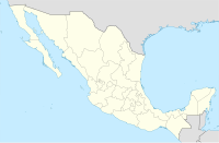
Tepic International Airport
Appearance
Amado Nervo International Airport Aeropuerto Internacional Amado Nervo | |||||||||||
|---|---|---|---|---|---|---|---|---|---|---|---|
 | |||||||||||
| Summary | |||||||||||
| Airport type | Public | ||||||||||
| Operator | Aeropuertos y Servicios Auxiliares | ||||||||||
| Serves | Tepic | ||||||||||
| Elevation AMSL | 3,020 ft / 920 m | ||||||||||
| Coordinates | 21°25′10.03″N 104°50′33.29″W / 21.4194528°N 104.8425806°W | ||||||||||
| Website | www.aeropuertosasa.mx/TPQ | ||||||||||
| Map | |||||||||||
 | |||||||||||
| Runways | |||||||||||
| |||||||||||
| Statistics (2022) | |||||||||||
| |||||||||||
Source: Aeropuertos y Servicios Auxiliares | |||||||||||
Amado Nervo National Airport or Tepic Airport (IATA: TPQ, ICAO: MMEP) is an international airport located at Tepic and the main airport in the Mexican state of Nayarit. Operated by Aeropuertos y Servicios Auxiliares, a federal government-owned corporation, it was Transportes Aereos de Nayarit's base before it ceased operations in 1999. It is named for the locally born poet Amado Nervo.
Information
The airport has one terminal with one concourse.
During 2021, it handled 171,998 passengers and during 2022 it handled 205,617 passengers.[1]
Airlines and destinations


| Airlines | Destinations |
|---|---|
| Aeroméxico Connect | Mexico City |
| Volaris | Tijuana |
Destinations map
| Destinations map |
|---|
Domestic destinations from Tepic International Airport Red = Year-round destination Blue = Future destination Italic = Suspended destination |
Statistics
Passengers
Graphs are unavailable due to technical issues. Updates on reimplementing the Graph extension, which will be known as the Chart extension, can be found on Phabricator and on MediaWiki.org. |
Tepic Airport Passengers.
See Wikidata query.
See also
References
- ^ "Operational Statistics of Airports in the ASA Network" (in Spanish). Aeropuertos y Servicios Auxiliares. January 2023. Retrieved January 15, 2023.
External links


