El Tajín National Airport
Appearance
El Tajín National Airport Aeropuerto Nacional El Tajín | |||||||||||
|---|---|---|---|---|---|---|---|---|---|---|---|
| File:Aeropuerto de Poza Rica.jpg | |||||||||||
| Summary | |||||||||||
| Airport type | Public | ||||||||||
| Operator | Aeropuertos y Servicios Auxiliares | ||||||||||
| Serves | Poza Rica, Veracruz | ||||||||||
| Location | Tihuatlán, Veracruz | ||||||||||
| Elevation AMSL | 497 ft / 151 m | ||||||||||
| Coordinates | 20°36′09″N 97°27′39″W / 20.60250°N 97.46083°W | ||||||||||
| Website | www.aeropuertosasa.mx/PAZ | ||||||||||
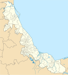
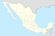
| Map | |||||||||||
 | |||||||||||
| Runways | |||||||||||
| |||||||||||
| Statistics (2022) | |||||||||||
| |||||||||||
Source: Aeropuertos y Servicios Auxiliares | |||||||||||
El Tajín National Airport (IATA: PAZ, ICAO: MMPA) is an international airport located in Tihuatlán, Veracruz, Mexico, near Poza Rica. The airport is named after the archeological site of El Tajín. It handles commercial air traffic for the cities of Poza Rica and Túxpam. Aeropuertos y Servicios Auxiliares, a federal government-owned corporation, operates the airport.
In 2021, the airport handled 2,645 passengers, and in 2022 it handled 2,666 passengers.[1]
Statistics
Passengers
Graphs are unavailable due to technical issues. Updates on reimplementing the Graph extension, which will be known as the Chart extension, can be found on Phabricator and on MediaWiki.org. |
Poza Rica Airport Passengers.
See Wikidata query.
See also
References
- ^ "Estadística Operacional de los Aeropuertos de la Red ASA" (in Spanish). January 2023. Retrieved January 15, 2022.
External links


