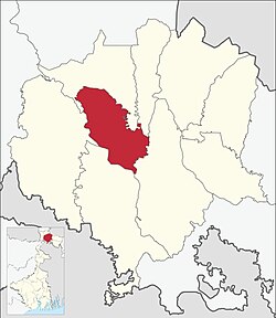
Kranti (community development block)
Appearance
Kranti | |
|---|---|
Community development block | |
 Kranti (community development block) | |
 | |
| Coordinates: 26°41′N 88°43′E / 26.69°N 88.72°E | |
| Country | |
| State | West Bengal |
| District | Jalpaiguri |
| Population (2011) | |
• Total | 123,649 |
| Languages | |
| • Official | Bengali, English |
| Time zone | UTC+5:30 (IST) |
| Lok Sabha constituency | Jalpaiguri |
| Vidhan Sabha constituency | Mal |
| Website | jalpaiguri |
Kranti is a community development block (CD block) that forms an administrative division in the Malbazar subdivision of the Jalpaiguri district in the Indian state of West Bengal. [1][2]
Geography
Kranti is located at 26°41′N 88°43′E / 26.69°N 88.72°E.
The Kranti CD block consists of 6 gram panchayats and It has 1 panchayat samiti.[3]
Gram panchayats of Kranti CD block/panchayat samiti are: Kranti, Rajadanga, Changmari, Lataguri, Chapadanga and Moulani Gram Panchayats. [4][5]
References
- ^ "Jalpaiguri". District Profile. District administration. Retrieved 14 July 2023.
- ^ "Happy about new block, Jalpaiguri citizens offer state free land for offices". The Telegraph Online. Retrieved 14 July 2023.
- ^ "নবগঠিত ক্রান্তি ব্লকে তৈরি হল পঞ্চায়েত সমিতি, নির্বাচিত হলেন পদাধিকারিরা". 14 July 2023.
- ^ "ক্রান্তি ব্লকে সিলমোহর মন্ত্রীসভার, উৎসব লাটাগুড়িতে". 14 July 2023.
- ^ "জলপাইগুড়িতে দু'টি নতুন ব্লক- বানারহাট ও ক্রান্তি, অনুমোদন রাজ্যের". 14 July 2023.
This article has not been added to any content categories. Please help out by adding categories to it so that it can be listed with similar articles, in addition to a stub category. (July 2023) |
