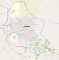
Narayanpur, Dharwad
 | Draft article not currently submitted for review.
This is a draft Articles for creation (AfC) submission. It is not currently pending review. While there are no deadlines, abandoned drafts may be deleted after six months. To edit the draft click on the "Edit" tab at the top of the window. To be accepted, a draft should:
It is strongly discouraged to write about yourself, your business or employer. If you do so, you must declare it. This draft has not been edited in over six months and qualifies to be deleted per CSD G13.
Where to get help
How to improve a draft
You can also browse Wikipedia:Featured articles and Wikipedia:Good articles to find examples of Wikipedia's best writing on topics similar to your proposed article. Improving your odds of a speedy review To improve your odds of a faster review, tag your draft with relevant WikiProject tags using the button below. This will let reviewers know a new draft has been submitted in their area of interest. For instance, if you wrote about a female astronomer, you would want to add the Biography, Astronomy, and Women scientists tags. Editor resources Last edited by Shailesh sappo (talk | contribs) 16 months ago. (Update) |
Narayanpura
Narayanpura | |
|---|---|
Neighbourhood | |
| Narayanpura | |
From top, Jubilee Circle, National Highway 48 in Narayanpur | |
| Coordinates: 15°27′41″N 74°59′55″E / 15.461411°N 74.998483°E | |
| State | Karnataka |
| District | Dharwad district |
| Metro | Dharwad |
| ward | 02[1] |
| Government | |
| • Type | Municipal Corporation |
| • Body | HDMC |
| Languages | |
| • Official | Kannada |
| Time zone | UTC+5:30 (IST) |
| PIN | 580008 |
| Vehicle registration | KA-25 |
| Lok Sabha constituency | Dharwad Lok Sabha constituency |
| Vidhan Sabha constituency | Dharwad Assembly constituency |
| Planning agency | Hubballi-Dharwad Urban Development Authority (HDUDA) |
Narayanpura, also known as Narayanpur is a locality in Northwestern part of Dharwad city which consists of many commerical and residential colonies. It has some of the important government structures such as Kalabhavan, District court and Dharwad Institute of Mental Health and Neurosciences (DIMHANS) on the National Highway 48.[2][3][4][5]
References
- ^ "HDMC zone and ward numbers" (PDF).
- ^ "Kalabhavan ready to be reopened". The Hindu. 2015-04-10. ISSN 0971-751X. Retrieved 2023-08-07.
- ^ "Dharwad/District Court in India | Official Website of District Court of India". districts.ecourts.gov.in. Retrieved 2023-08-07.
- ^ "Introduction of DIMHANS - DHARWAD INSTITUTE OF MENTAL HEALTH AND NEUROSCIENCES, NARAYANPURA". dimhans.karnataka.gov.in. Retrieved 2023-08-07.
- ^ "National Highway 48 (NH48) Travel Guide - Roadnow". roadnow.in. Retrieved 2023-08-07.


