Stathelle
Stathelle | |
|---|---|
 View of the town | |
| Coordinates: 59°02′42″N 9°41′54″E / 59.04511°N 9.69821°E | |
| Country | Norway |
| Region | Eastern Norway |
| County | Vestfold og Telemark |
| District | Grenland |
| Municipality | Bamble Municipality |
| Established as | |
| Ladested | 1774 |
| Elevation | 4 m (13 ft) |
| Time zone | UTC+01:00 (CET) |
| • Summer (DST) | UTC+02:00 (CEST) |
| Post Code | 3960 Stathelle |
| Stathelle ladested | |
 Telemark within Norway | |
 Stathelle within Telemark | |
| Country | Norway |
| County | Telemark |
| District | Grenland |
| Established | 1 Jan 1838 |
| • Created as | Formannskapsdistrikt |
| Disestablished | 1 Jan 1964 |
| • Succeeded by | Bamble Municipality |
| Administrative centre | Stathelle |
| Population (1964) | |
• Total | 724 |
| ISO 3166 code | NO-0803[3] |
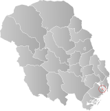
ⓘ is a town in Bamble Municipality in Vestfold og Telemark county, Norway. The town is located at the confluence of the Frierfjorden, Eidangerfjord, and Langesundsfjorden. The town of Brevik lies about 1 kilometre (0.62 mi) across the fjord and the town of Langesund lies about 4 kilometres (2.5 mi) to the southeast. Stathelle Church is located in the town.[4]
For a long time, Stathelle and neighboring Langesund have been grouped together as part of the Porsgrunn/Skien metropolitan area and because of this, the population and area data for this town has not been separately tracked by Statistics Norway. What is tracked, is the portion of the metropolitan area located in Bamble Municipality. In 2022, the Langesund/Stathelle area in Bamble measured 6.34 square kilometres (1,570 acres) and together they had a population of 10,276 with a population density of 1,622 inhabitants per square kilometre (4,200/sq mi).[5]
History
Stathelle is an old trading town and it was granted ladested rights (port town status) on 22 February 1774.[4][6] the In the middle of the 1800s, Stathelle was an enterprising seaport, characterized by the trading house established by Albert Blehr on Kjellestad, which was one of the nation's largest timber exporters. (Today there is a marina and a park in the same area.)[7]
Brevik bridge was constructed during 1962. Previously travelers along the southern highway between Oslo and Stavanger had to take the ferry between the towns of Brevik and Stathelle.
Hansen & Arntzen Co AS is a traditional shipyard in Stathelle that specializes in the restoration of vessels. Hansen & Arntzen AS Ekstrand Co. was established in 1929 as a family business. The company is known for its significant repair and restoration projects. Many famous ships have been restored there, including the Norwegian Royal Yacht HNoMY Norge.[8]
Name
The town is named Stathelle. The first element comes from the word staðr which means "place" or "town". The last element is hella which means "flagstone" or "slab of rock".[4]
Municipal self-government (1838-1964)
The town of Stathelle was established as a municipality on 1 January 1838 (see formannskapsdistrikt law). During the 1960s, there were many municipal mergers across Norway due to the work of the Schei Committee. On 1 January 1964, the town of Stathelle (population: 724) was merged with the nearby town of Langesund (population: 2,281) and the surrounding rural municipality of Bamble (population: 5,237) to form a new, larger Bamble Municipality.[9]
Notable people
- Knud Karl Krogh-Tonning (1842–1911), a Norwegian theologian who was born in Stathelle
- Turid Thomassen (born 1965), a politician
- Ella Gjømle Berg (born 1979), a cross country skier
See also
- Stathel and staddle stones
- List of towns and cities in Norway
- List of former municipalities of Norway
References
- ^ In the Norwegian language, the word by can be translated as "town" or "city".
- ^ "Stathelle, Bamble". yr.no. Retrieved 19 September 2023.
- ^ Bolstad, Erik; Thorsnæs, Geir, eds. (26 January 2023). "Kommunenummer". Store norske leksikon (in Norwegian). Kunnskapsforlaget.
- ^ a b c Lundbo, Sten, ed. (30 June 2022). "Stathelle". Store norske leksikon (in Norwegian). Kunnskapsforlaget. Retrieved 20 September 2023.
- ^ Statistisk sentralbyrå (1 January 2022). "Urban settlements. Population and area, by municipality".
- ^ Helland, Amund (1900). "Stathelle ladested". VIII. Bratsberg Amt. Anden del. Norges land og folk (in Norwegian). Kristiania, Norway: H. Aschehoug & Company. p. 225. Retrieved 20 September 2023.
- ^ The family of Albert Blehr who died in 1800, was documented by the Norwegian genealogist, C. S. Schilbred, first chairman and founding member of the Norwegian Heraldry Society in Bygdebok for Bamble (published by Bamble kommune, 1968)
- ^ "The Royal Yacht: History". Kongehuset.
- ^ Jukvam, Dag (1999). "Historisk oversikt over endringer i kommune- og fylkesinndelingen" (PDF) (in Norwegian). Statistisk sentralbyrå. ISBN 9788253746845.
External links


