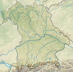
Seehamer See
Appearance
| Seehamer See | |
|---|---|
 | |
| Location | Alpine foothills, Bavaria |
| Coordinates | 47°51′0″N 11°51′22″E / 47.85000°N 11.85611°E |
| Primary inflows | Mangfall, Schlierach, Leitzach (artificial) |
| Primary outflows | Moosbach |
| Basin countries | Germany |
| Surface area | 1.47 km2 (0.57 sq mi) |
| Max. depth | 22 m (72 ft) |
| Surface elevation | 653 m (2,142 ft) |
Seehamer See is a lake in the Alpine foothills, Bavaria, Germany. At an elevation of 653 m, its surface area is 1.47 km2.
See also
[edit]

