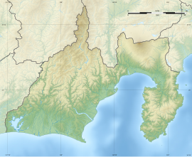
Wadaoka Kofun group
和田岡古墳群 | |
 Yoshioka-Otsuka Kofun before renovation | |
| Location | Kakegawa, Shizuoka, Japan |
|---|---|
| Region | Tōkai region |
| Coordinates | 34°46′40″N 137°57′06″E / 34.77778°N 137.95167°E |
| Type | kofun |
| History | |
| Founded | 5th to 6th century AD |
| Periods | Kofun period |
| Site notes | |
| Public access | Yes |
The Wadaoka Kofun group (和田岡古墳群, Wadaoka kofun-gun) is an archaeological site with a cluster of burial mounds from the Kofun period located in what is now part of the city of Kakegawa, Shizuoka in the Tōkai region of Japan. The site was designated a National Historic Site of Japan in 1996.[1]
Overview
[edit]The Wadaoka Kofun group is located in an area measuring approximately 2.5 kilometers north-south by one kilometer east-west, on a low plateau overlooking the Haranoya River west of the downtown area of modern Kakegawa city. The site consists of four keyhole-shaped kofun (zenpō-kōen-fun (前方後円墳)), 15 circular-shaped kofun (empun (円墳)), and four square-shaped kofun (hōfun (方墳)), all dating from the 5th century to the sixth century AD. [2] The largest include:
| Name | Type | Length |
|---|---|---|
| Wakanezuka Kofun 各和金塚古墳 |
keyhole | 66.4 meters Anterior: 20.5 m wide x 4 m high: Posterior 51.2 m diameter x 6.5 m high |
| Hisagozuka Kofun 瓢塚古墳 |
keyhole | 63 meters long Anterior: 25.2 m wide x 3.5 m high: Posterior 37.8 m diameter x 3.5 m high |
| Yoshioka-Otsuka Kofun 吉岡大塚古墳 |
keyhole | 55 meters long Anterior: 27.5 m wide x 2.5 m high: Posterior 41.3 m diameter x 7.2 m high |
| Gyojinzuka Kofun 行人塚古墳 |
keyhole | 43.7 meters long Anterior: 16 m wide: Posterior 25.4 m diameter |
| Harubayashiin Kofun 春林院古墳 |
circular | 35 meters, height 5 meters |
| Usa-Hachiman-sha Kofun | circular | 30 meter diameter |
| Gongenyama Kofun | circular | 40 meter diameter |
| Ishinogata Kofun | circular | 25 meter diameter |
These tumuli are believed to be the tombs of local kings who ruled the Haranodani River basin. The Wakanezuka Kofun is considered the oldest, but its pit-type burial chamber was robbed in 1974 before a proper archaeological excavation could be made. Many of the tumuli were once covered in fukiishi and had haniwa clay figurines, and the Yoshioka-Otsuka Kofun has traces of a moat remaining. Grave goods recovered from the tombs included, large numbers of iron weapons, fragments of armor, pottery shards and shinju-kyo bronze mirrors. [2]
The necropolis is located approximately 15 minutes on foot from the Tenryu Hamanako Line's Hosoya Station. There are plans to make an archaeological park in the area.[2]
See also
[edit]References
[edit]- ^ "和田岡古墳群" (in Japanese). Agency for Cultural Affairs.
- ^ a b c Isomura, Yukio; Sakai, Hideya (2012). (国指定史跡事典) National Historic Site Encyclopedia. 学生社. ISBN 4311750404.(in Japanese)
External links
[edit]- Kakegawa home page (in Japanese)


