Qashqadaryo Region
Kashkadarya Region
Қашқадарё вилояти /
Qashqadaryo viloyati Кашкадарьинская область | |
|---|---|
Region | |
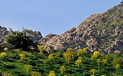 Qashqadaryo Region | |
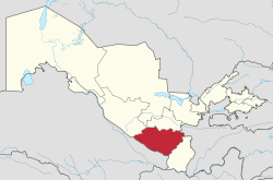 Qashqadaryo in Uzbekistan | |
| Coordinates: 38°50′N 66°50′E / 38.833°N 66.833°E | |
| Country | Uzbekistan |
| Capital | Qarshi |
| Government | |
| • Hokim | Murotjon Azimov |
| Area | |
• Total | 28,568 km2 (11,030 sq mi) |
| Elevation | 480 m (1,570 ft) |
| Population (2022) | |
• Total | 3,408,345 |
| • Density | 120/km2 (310/sq mi) |
| Time zone | UTC+5 (East) |
| ISO 3166 code | UZ-QA |
| Districts | 13 |
| Cities | 12 |
| Towns | 117 |
| Villages | 1041 |
| Website | www |
Qashqadaryo Region (Template:Lang-uz, Қашқадарё вилояти, قشقهدریا ولایتی; old spelling Kashkadarya Region, Template:Lang-ru) is one of the regions of Uzbekistan, located in the south-eastern part of the country in the basin of the river Qashqadaryo and on the western slopes of the Pamir-Alay mountains. It borders with Tajikistan, Turkmenistan, Samarqand Region, Bukhara Region and Surxondaryo Region. It covers an area of 28,570 km2.[1] The population is estimated 3,408,345 (2022), with 57% living in rural areas.[2][3] The regional capital is Qarshi (278,300 inhabitants).
Administrative divisions
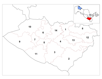
The Qashqadaryo Region consists of 13 districts (listed below) and two district-level cities: Qarshi and Shahrisabz.[1][4]
| District name | District capital | |
|---|---|---|
| 1 | Chiroqchi District | Chiroqchi |
| 2 | Dehqonobod District | Qorashina |
| 3 | Gʻuzor District | Gʻuzor |
| 4 | Qamashi District | Qamashi |
| 5 | Qarshi District | Beshkent |
| 6 | Koson District | Koson |
| 7 | Kasbi District | Mugʻlon |
| 8 | Kitob District | Kitob |
| 9 | Mirishkor District | Yangi Mirishkor |
| 10 | Muborak District | Muborak |
| 11 | Nishon District | Yangi Nishon |
| 12 | Shahrisabz District | Shahrisabz |
| 13 | Yakkabogʻ District | Yakkabogʻ |
| 14 | Ko'kdala District | Ko'kdala |
There are 12 cities (Qarshi, Shahrisabz, Gʻuzor, Qamashi, Beshkent, Koson, Kitob, Muborak, Yangi Nishon, Tallimarjon, Chiroqchi, Yakkabogʻ) and 117 urban-type settlements in the Qashqadaryo Region.[1][4]
Geography
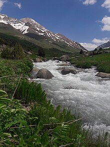
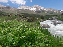
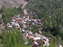
The climate is a typically arid continental climate and partly semi-tropical. Region involves a number of rivers, mountain ranges(Hisar), reserves (Kitab State Geological Reserve, Hisar State Reserve) and lakes.
Historical buildings
Mubarak Mervazi Mausoleum was built in the 14th century. It is located in the "Sariqqishloq" neighborhood in the Mubarak district of the Kashkadarya region.[5] By the decision of the Cabinet of Ministers of the Republic of Uzbekistan on October 4, 2019, it was included in the national list of immovable property objects of tangible cultural heritage - under state protection.[6][7]
Economy
Natural resources include significant petroleum and natural gas reserves, with the Muborak Oil and Gas Processing Plant as the region's largest industry. Other industry includes wool processing, textiles, light industry, food processing and construction materials. Major agricultural activities include cotton, various crops and livestock. The irrigation infrastructure is very well developed with the large Tallimarjon Reservoir as a reliable water source.
The region has a well-developed transport infrastructure, with over 350 km of railways and 4000 km of surfaced roads.
Culture
The city of Shahrisabz, the birthplace of Amir Timur, is the main tourist attraction in the region.
References
- ^ a b c "Oʻzbekiston Respublikasining maʼmuriy-hududiy boʻlinishi" [Administrative-territorial division of the Republic of Uzbekistan] (in Uzbek). The State Committee of the Republic of Uzbekistan on statistics. July 2021. Archived from the original on 4 February 2022.
- ^ "Ўзбекистонда энг кўп аҳоли қайси вилоятда яшайди?". Qalampir.uz (in Uzbek). Retrieved 2022-02-11.
- ^ "Urban and rural population by district" (PDF) (in Uzbek). Qashqadaryo regional department of statistics.
- ^ a b "Classification system of territorial units of the Republic of Uzbekistan" (in Uzbek and Russian). The State Committee of the Republic of Uzbekistan on statistics. July 2020.
- ^ "Qashqadaryo viloyati". uzbekistan.travel. Retrieved 2023-11-14.
- ^ ""Moddiy madaniy merosning koʻchmas mulk obyektlari milliy roʻyxatini tasdiqlash toʻgʻrisida Oʻzbekiston Respublikasi Vazirlar Mahkamasining 2019-yil 4-oktyabrdagi 846-sonli qarori"". lex.uz. Retrieved 2023-11-14.
- ^ "MODDIY MADANIY MEROSNING KO'CHMAS MULK OBYEKTLARI MILLIY RO'YXATINI TASDIQLASH TO'G'RISIDA" (PDF). backend.madaniymeros.uz. Retrieved 2023-11-14.

