Coutts/Ross International Airport
| Summary | |||||||||||
|---|---|---|---|---|---|---|---|---|---|---|---|
| Airport type | Public | ||||||||||
| Owner | State of Montana[3] | ||||||||||
| Operator | Montana Aeronautics Division[3] | ||||||||||
| Serves | Coutts, Alberta[1] Sweet Grass, Montana[2] | ||||||||||
| Location | Canada–United States border | ||||||||||
| Time zone | MST (UTC−07:00) | ||||||||||
| • Summer (DST) | MDT (UTC−06:00) | ||||||||||
| Elevation AMSL | 3,552 ft / 1,083 m | ||||||||||
| Coordinates | 48°59′55″N 111°58′39″W / 48.99861°N 111.97750°W[2] 48°59′54″N 111°58′42″W / 48.99833°N 111.97833°W[1] | ||||||||||
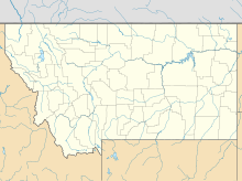
| Map | |||||||||||
 | |||||||||||
| Runways | |||||||||||
| |||||||||||
| Statistics (2007/2008) | |||||||||||
| |||||||||||
Coutts/Ross International Airport (FAA LID: 7S8, TC LID: CEP4) is located 0.5 nautical miles (0.93 km; 0.58 mi) west of Coutts, Alberta, Canada and 0.1 NM (0.19 km; 0.12 mi) west of Sweet Grass, Montana, United States.
Ross International Airport is owned by the U.S. state of Montana and is operated by the Montana Aeronautics Division. Its runway is located on the Canada–US border.[3]
The airport is one of six airports that straddle the Canada–US border. The others are Avey Field State Airport, Whetstone International Airport, International Peace Garden Airport, Piney Pinecreek Border Airport, and Coronach/Scobey Border Station Airport.
The airport is classified as an airport of entry by Nav Canada and is staffed by the Canada Border Services Agency (CBSA). CBSA officers at this airport can handle general aviation aircraft only, with no more than 15 passengers.[1]
Facilities and aircraft
The airport covers an area of 20 acres (8.1 ha) at an elevation of 3,552 ft (1,083 m)[2][1] above mean sea level. It has one runway designated 7/25 with a turf surface measuring 2,900 by 80 ft (884 by 24 m).[1][2] For the 12-month period ending August 23, 2008, the airport had 25 general aviation aircraft operations, an average of 2 per month.[2]photo?
See also
References
External links
- Page about this airport on COPA's Places to Fly airport directory
- Resources for this airport:
- FAA airport information for 7S8
- AirNav airport information for 7S8
- FlightAware airport information and live flight tracker
- SkyVector aeronautical chart for 7S8

