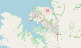
Fannie Bay, Northern Territory
| Fannie Bay Darwin, Northern Territory | |||||||||||||||
|---|---|---|---|---|---|---|---|---|---|---|---|---|---|---|---|
 Fannie Bay, Darwin | |||||||||||||||
 | |||||||||||||||
| Coordinates | 12°25′37″S 130°50′25″E / 12.427°S 130.8402°E[1] | ||||||||||||||
| Population | 2,624 (2016 census)[2] | ||||||||||||||
| • Density | 570.4/km2 (1,477.4/sq mi) | ||||||||||||||
| Postcode(s) | 0820 | ||||||||||||||
| Area | 4.60 km2 (1.8 sq mi) | ||||||||||||||
| Location | 4 km (2 mi) from Darwin | ||||||||||||||
| LGA(s) | City of Darwin | ||||||||||||||
| Territory electorate(s) | Fannie Bay | ||||||||||||||
| Federal division(s) | Solomon | ||||||||||||||
| |||||||||||||||
| Footnotes | Adjoining suburbs[3][4] | ||||||||||||||
Fannie Bay is a middle/inner suburb of the city of Darwin, Northern Territory, Australia. It is the traditional country and waterways of the Larrakia people.[5]
Situated in the suburb is the Fannie Bay Gaol museum, Fannie Bay Race Track, Fannie Bay Oval the home of the Port Darwin FC and a monument to Ross Smith, captain of the Vickers Vimy, that on 10 December 1919, was the first aircraft to fly from England to Australia in less than 30 days. Adjoining the suburb is the East Point Reserve, containing Lake Alexander, a Military Museum and gun emplacements from the Second World War.
A great many places in the Northern Territory were named by John McDouall Stuart[citation needed] for members of the Chambers family, who sponsored his expeditions. Fannie Bay on the other hand was named by George Goyder after Fanny Carandini, an opera singer.[6]
References
[edit]- ^ "Place Names Register Extract for "Fannie Bay" (suburb)". NT Place Names Register. Northern Territory Government. Retrieved 26 March 2019.
- ^ Australian Bureau of Statistics (27 June 2017). "Fannie Bay (State Suburb)". 2016 Census QuickStats. Retrieved 28 June 2017.
- ^ "Fannie Bay". NT Atlas and Spatial Data Directory. Northern Territory Government. February 2005. Retrieved 26 March 2019.
- ^ "Darwin City Council Suburbs" (PDF). Northern Territory Government. Archived from the original (PDF) on 18 March 2019. Retrieved 13 March 2019.
- ^ "The Larrakia People". Larrakia Nation. 31 March 2023. Retrieved 1 December 2023.
- ^ "Place Names Register".
External links
[edit]

