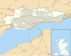
Dundee Castle
Appearance
56°27′40″N 2°58′05″W / 56.4610°N 2.9680°W
| Dundee Castle | |
|---|---|
| Coordinates | 56°27′40″N 2°58′05″W / 56.4610°N 2.9680°W |
Dundee Castle was a castle in Dundee, Scotland,[1] that Robert the Bruce destroyed in 1313.
Dundee was created a royal burgh by King William the Lion in the 13th century. The castle was surrendered to the English in 1296. William Wallace laid siege to Dundee Castle in 1297, and the garrison surrendered before the Battle of Stirling Bridge. The castle was captured again by the English in 1300 and again in 1303 and 1310. King Edward I of England visited the castle in 1300 and 1303 and repaired it. Edward de Brus captured and destroyed the castle held by Constable William de Montfichet in 1312/13. St. Paul's Cathedral was later built on its site.
References
[edit]- This article incorporates text from a publication now in the public domain: Chisholm, Hugh, ed. (1911). "Dundee". Encyclopædia Britannica (11th ed.). Cambridge University Press.


