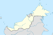
Sematan Airport
Appearance
Sematan Airport | |
|---|---|
| Summary | |
| Airport type | Private |
| Operator | Malaysia Airports Berhad |
| Serves | Sematan, Sarawak, Malaysia |
| Time zone | MST (UTC+08:00) |
| Coordinates | 01°48′49″N 109°45′46″E / 1.81361°N 109.76278°E |
| Map | |
 | |
Source: Great Circle Mapper[1] | |
Sematan Airport (IATA: BSE, ICAO: WBGN) is located in Sematan, Lundu District, Sarawak, Malaysia.[1]
History
The Sematan airfield was officiated in September 1958 where Borneo Airways Twin Pioneer aircraft was first landed here.
There are no scheduled flights at this airport. The fact that this airport For RMAF. In 1974 there was a helicopter crash killing 2 or 3 generals. From then, no more than one high tanking officer allowed per helicopter.[citation needed]
See also
References
- ^ a b Airport information for BSE at Great Circle Mapper.
External links

