Banding Island
Tools
Actions
General
Print/export
In other projects
Appearance
From Wikipedia, the free encyclopedia
This is an old revision of this page, as edited by 180.75.233.40 (talk) at 07:07, 21 May 2024 (Only Malay are the official language of Malaysia.). The present address (URL) is a permanent link to this revision, which may differ significantly from the current revision.
Revision as of 07:07, 21 May 2024 by 180.75.233.40 (talk) (Only Malay are the official language of Malaysia.)
Island in Malaysia
Native name: Pulau Banding ڤولاو بنديڠ | |
|---|---|
| Geography | |
| Location | Lake Temenggor |
| Coordinates | 5°33′N 101°20′E / 5.550°N 101.333°E / 5.550; 101.333 |
| Administration | |
| State | Perak |
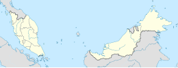
Banding Island (locally Pulau Banding) is an artificial island within the man-made Lake Temenggor, created by the construction of Temenggor Dam in Perak, Malaysia.
| NCER Perlis |
|
|---|---|
| NCER Kedah | |
| NCER Penang |
|
| NCER Perak | |
5°33′N 101°20′E / 5.550°N 101.333°E / 5.550; 101.333

