Geising
Appearance
Geising | |
|---|---|
| Coordinates: 50°45′29″N 13°47′28″E / 50.75806°N 13.79111°E | |
| Country | Germany |
| State | Saxony |
| District | Sächsische Schweiz-Osterzgebirge |
| Town | Altenberg |
| Area | |
• Total | 56.07 km2 (21.65 sq mi) |
| Elevation | 666 m (2,185 ft) |
| Population (2009-12-31) | |
• Total | 3,145 |
| • Density | 56/km2 (150/sq mi) |
| Time zone | UTC+01:00 (CET) |
| • Summer (DST) | UTC+02:00 (CEST) |
| Postal codes | 01778 |
| Dialling codes | 035056 |
| Vehicle registration | PIR |
| Website | www.geising.de |
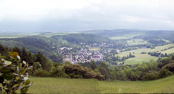
Geising is a Stadtteil (municipal division) of Altenberg in the Sächsische Schweiz-Osterzgebirge district, in Saxony, Germany.[1] It is situated in the Ore Mountains, close to the border with the Czech Republic, 13 km (8.1 mi) north of Teplice, and 32 km (20 mi) south of Dresden. Since 1 January 2011, it is part of the town Altenberg.[2]
References
[edit]Wikimedia Commons has media related to Geising.
You can help expand this article with text translated from the corresponding article in German. (November 2019) Click [show] for important translation instructions.
|


