Quinchía
Quinchía | |
|---|---|
Town and Municipality | |
| Quinchía | |
| Nickname(s): Villa de los Cerros, (Village of the Hills) | |
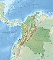
 Location of Quinchía in the department of Risaralda. | |
| Coordinates (Urban area): 5°20′16.26″N 75°43′46.73″W / 5.3378500°N 75.7296472°W | |
| Country | |
| Department | |
| Region | Andean Region of Colombia |
| Cultural Area | Colombian Coffee-Growers Axis |
| Founded | 1888 |
| Administrative Division | Boroughs |
| Government | |
| • Type | Strong Mayor-Council |
| • Mayor | Alicia Palacio Restrepo (2008-2011) |
| Area | |
• Total | 149.8 km2 (57.8 sq mi) |
| Elevation | 1,825 m (5,988 ft) |
| Population (2023) | |
• Total | 27,890 |
| • Density | 190/km2 (480/sq mi) |
| According to National Department for Statistics of Colombia (DANE) | |
| Time zone | UTC-5 (Bogotá, (Colombia).) |
| Website | http://quinchia-risaralda.gov.co/index.shtml |
Quinchía, also known as Villa de los Cerros (Village of the Hills), is a town and municipality in the Department of Risaralda, Colombia. About 110 km away from the capital Pereira. In 2023 the town had an estimated population of 27,890.[1]
History
[edit]Around 1842, the decimated indigenous population, as a result of the violence against them by the Spaniards, decided to formalize the organization of the hamlet, creating Quinchía Viejo. On November 29, 1886, the current municipality of Quinchía emerged, by the will of Messrs. Gabriel Vinasco, Zoilo Bermúdez, José Natalio and Protasio Gómez.
Quinchia was officialized on November 29, 1888, also On April 24, 1912 the town was declared a municipality. At the beginning of the 20th century, the Indigenous Reservation would end, through negotiations and all kinds of maneuvers by the Antioquia settlers who ended up taking over the lands.[2]
It's located in the Colombian coffee growing axis, part of the "Coffee Cultural Landscape" UNESCO World Heritage Site in 2011.
Climate
[edit]Quinchía has a subtropical highland climate with an average annual temperature of 18 °C.[3]
References
[edit]- ^ Telefónicas, Telencuestas-Encuestas. "Cuántos habitantes tiene Quinchía, Risaralda en 2023". Telencuestas (in Spanish). Retrieved 2023-09-28.
- ^ Risaralda, Gobernación de (2016-09-28). "Quinchía". Gobernación de Risaralda (in Spanish). Retrieved 2023-09-28.
- ^ "RISARALDA-QUINCHIA". www.colombiaturismoweb.com. Retrieved 2023-09-28.
External links
[edit]- Official Website Official website of Quinchía's Town Hall.
- Hospital Nazareth[permanent dead link] Hospital Nazareth, located at the urban area of Quinchía, provides health services to local community.
- QTV Blog of the local radio station a TV channel. Radio Quinchía Televisión.
- Quinchía.com Archived 2010-01-12 at the Wayback Machine Website about Quinchía, Risaralda.


