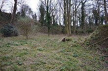
South Lodge Pit
Appearance
| Site of Special Scientific Interest | |
 | |
| Location | Buckinghamshire |
|---|---|
| Grid reference | SU905819 |
| Interest | Geological |
| Area | 0.5 hectares |
| Notification | 1986 |
| Location map | Magic Map |
South Lodge Pit is a 0.5-hectare (1.2-acre) geological Site of Special Scientific Interest in Taplow in Buckinghamshire.[1][2] It is a Geological Conservation Review site.[3]
This former chalk quarry dates to the late Cretaceous, around 83 million year ago. It is the only British example of a chalk phosphorite deposit, comparable to deposits in the Paris Basin.[1] In the late Cretaceous sea levels were much higher and covered much of England, including Buckinghamshire.[4] Marine fossils are found in several horizons, including annelids, oysters and bivalves.[5]
The site is on private land with no public access.
Wikimedia Commons has media related to South Lodge Pit.
References
[edit]- ^ a b "South Lodge Pit citation" (PDF). Sites of Special Scientific Interest. Natural England. Archived from the original (PDF) on 4 March 2016. Retrieved 29 February 2016.
- ^ "Map of South Lodge Pit". Sites of Special Scientific Interest. Natural England. Retrieved 29 February 2016.
- ^ "South Lodge Pit (Cenomanian, Turonian, Senonian, Maastrichtian)". Joint Nature Conservation Committee. Retrieved 29 February 2016.
- ^ "South Lodge Pit". Taplow Society. Retrieved 29 February 2016.
- ^ "South Lodge Pit SSSI". Bucks Geology. Retrieved 29 February 2016.
