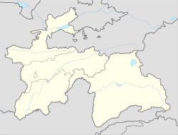
Danghara
Danghara
| |
|---|---|
| Coordinates: 38°05′54″N 69°20′48″E / 38.09833°N 69.34667°E | |
| Country | |
| Region | Khatlon |
| District | Danghara |
| Elevation | 649 m (2,129 ft) |
| Population (2020) | |
• Total | 31,100 |
| Official languages | |
Danghara (Template:Lang-tg), is a town in the Khatlon Region of Tajikistan. It is the capital of Danghara District. It is the hometown of Tajikistan's president, Emomali Rahmon as well as the country's first deputy prime minister, Asadullo Ghulomov, and several other senior government officials and members of parliament.[2] As of 2020, the town's population was estimated at 31,100.[3]
In 2012, Radio Free Europe reported that the town might be the target of a plan to relocate the country's capital city. The rumors were spurred by the fact that a new international airport was being constructed in the area. Additionally, a major rail line was rerouted and the town's roads renovated.[4]
2018 terrorist attack
In 2018, four Western cyclists were killed near Danghara, by five men who claimed to be affiliated with the Islamic State of Iraq and the Levant. Two other cyclists were injured in the attack.
Climate
Danghara has a hot-summer Mediterranean climate (Köppen climate classification Csa).
| Climate data for Danghara | |||||||||||||
|---|---|---|---|---|---|---|---|---|---|---|---|---|---|
| Month | Jan | Feb | Mar | Apr | May | Jun | Jul | Aug | Sep | Oct | Nov | Dec | Year |
| Mean daily maximum °C (°F) | 7.3 (45.1) |
9.9 (49.8) |
15.5 (59.9) |
22.5 (72.5) |
27.9 (82.2) |
34.3 (93.7) |
36.4 (97.5) |
35.2 (95.4) |
30.6 (87.1) |
23.7 (74.7) |
15.9 (60.6) |
9.7 (49.5) |
22.4 (72.3) |
| Mean daily minimum °C (°F) | −1.8 (28.8) |
0.0 (32.0) |
5.0 (41.0) |
10.3 (50.5) |
13.9 (57.0) |
17.6 (63.7) |
19.5 (67.1) |
17.7 (63.9) |
12.7 (54.9) |
8.2 (46.8) |
3.4 (38.1) |
0.3 (32.5) |
8.9 (48.0) |
| Average precipitation mm (inches) | 53 (2.1) |
66 (2.6) |
98 (3.9) |
76 (3.0) |
59 (2.3) |
5 (0.2) |
2 (0.1) |
0 (0) |
1 (0.0) |
24 (0.9) |
33 (1.3) |
49 (1.9) |
466 (18.3) |
| Source: Climate-data.org | |||||||||||||
Population
| 1959[5] | 1970[6] | 1979[7] | 1989[8] |
|---|---|---|---|
| 5761 | 9083 | 12 892 | 16 898 |
References
- ^ "КОНСТИТУЦИЯ РЕСПУБЛИКИ ТАДЖИКИСТАН". prokuratura.tj. Parliament of Tajikistan. Retrieved 9 January 2020.
- ^ Tajik First Deputy Prime Minister Dies , 03.08.2011 13:02 , http://www.rferl.org/content/tajik_deputy_prime_minister_dies/24285795.html
- ^ "Population of the Republic of Tajikistan as of 1 January 2020" (PDF) (in Russian). Statistics office of Tajikistan. Archived from the original (PDF) on 1 June 2021. Retrieved 15 October 2020.
- ^ Plans For A New Airport Invite Speculation In Tajikistan, 09.01.2012 18:27, http://www.rferl.org/content/tajikistan_rahmon_danghara_capital/24446724.html
- ^ Перепись-1959
- ^ Перепись-1970
- ^ Перепись-1979
- ^ Перепись-1989 Archived 2012-01-18 at the Wayback Machine


