Vale of York (UK Parliament constituency)
This article needs additional citations for verification. (December 2009) |
| Vale of York | |
|---|---|
| Former county constituency for the House of Commons | |
 Boundary of Vale of York in North Yorkshire for the 2005 general election | |
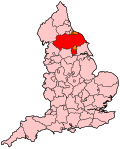
 Location of North Yorkshire within England | |
| County | North Yorkshire |
| Major settlements | Haxby, Rawcliffe, Clifton Without, Thirsk, Bedale, Easingwold |
| 1997–2010 | |
| Seats | One |
| Created from | Ryedale, Richmond, Yorks, Harrogate, Skipton and Ripon |
| Replaced by | See text |
Vale of York was a county constituency represented in the House of Commons of the Parliament of the United Kingdom. It elected one Member of Parliament (MP) by the first past the post system of election.
History
[edit]The constituency was created in 1997 from parts of the seats of Ryedale, Harrogate, Skipton and Ripon, & Richmond (Yorks). It was abolished in 2010.
Boundaries
[edit]The District of Hambleton wards of Bedale, Carlton Miniott, Crakehall, Crayke, Easingwold, Helperby, Hillside, Huby-Sutton, Leemming, Shipton, Sowerby, Stillington, Tanfield, The Thorntons, Thirsk, Tollerton, Topcliffe, and Whitestonecliffe, the District of Ryedale wards of Clifton Without, Haxby North East, Haxby West, New Earswick, Rawcliffe, Skelton, and Wigginton, and the Borough of Harrogate wards of Boroughbridge, Claro, Marston Moor, Nether Poppleton, Newby, Ouseburn, Spofforth, Upper Poppleton, and Wathvale.
This constituency covered the more northerly parts of the Vale of York and included the north-western suburbs of York and the market towns of Easingwold, Bedale, Boroughbridge and Thirsk. The three largest settlements were from the York suburbs.
The reconfiguration of North Yorkshire's constituencies by the Boundary Commission for England saw the creation of a York Central and a York Outer. The populous York suburbs became part of York Outer. Easingwold, Thirsk and surrounding villages joined rural Ryedale to form a new Thirsk and Malton constituency. Bedale rejoined the Richmond constituency. Boroughbridge became part of an enlarged Harrogate seat, while Skipton & Ripon regained some of the surrounding villages. The enlarged Selby and Ainsty seat now encompasses Marston Moor and Spofforth.
Members of Parliament
[edit]| Election | Member [1] | Party | |
|---|---|---|---|
| 1997 | Anne McIntosh | Conservative | |
| 2010 | constituency abolished: see York Outer, Thirsk and Malton, Richmond (Yorks), Harrogate and Knaresborough, Selby and Ainsty & Skipton and Ripon | ||
Elections
[edit]Elections in the 2000s
[edit]| Party | Candidate | Votes | % | ±% | |
|---|---|---|---|---|---|
| Conservative | Anne McIntosh | 26,025 | 51.7 | +0.1 | |
| Labour | David Scott | 12,313 | 24.4 | −1.4 | |
| Liberal Democrats | Jeremy Wilcock | 12,040 | 23.9 | +3.7 | |
| Majority | 13,712 | 27.3 | +1.5 | ||
| Turnout | 50,378 | 66.3 | +0.2 | ||
| Conservative hold | Swing | +0.7 | |||
| Party | Candidate | Votes | % | ±% | |
|---|---|---|---|---|---|
| Conservative | Anne McIntosh | 25,033 | 51.6 | +6.9 | |
| Labour | Chris Jukes | 12,516 | 25.8 | −0.7 | |
| Liberal Democrats | Greg Stone | 9,799 | 20.2 | −3.6 | |
| UKIP | Peter Thornber | 1,142 | 2.4 | New | |
| Majority | 12,517 | 25.8 | +7.6 | ||
| Turnout | 48,490 | 66.1 | −9.9 | ||
| Conservative hold | Swing | ||||
Elections in the 1990s
[edit]| Party | Candidate | Votes | % | ±% | |
|---|---|---|---|---|---|
| Conservative | Anne McIntosh | 23,815 | 44.7 | ||
| Labour | Matt Carter | 14,094 | 26.5 | ||
| Liberal Democrats | Charles Hall | 12,656 | 23.8 | ||
| Referendum | Clive Fairclough | 2,503 | 4.7 | ||
| SDP | Tony Pelton | 197 | 0.4 | ||
| Majority | 9,721 | 18.2 | |||
| Turnout | 53,265 | 76.0 | |||
| Conservative win (new seat) | |||||
See also
[edit]Notes and references
[edit]- ^ Leigh Rayment's Historical List of MPs – Constituencies beginning with "V"
- ^ "Election Data 2005". Electoral Calculus. Archived from the original on 15 October 2011. Retrieved 18 October 2015.
- ^ "Election Data 2001". Electoral Calculus. Archived from the original on 15 October 2011. Retrieved 18 October 2015.
- ^ "Election Data 1997". Electoral Calculus. Archived from the original on 15 October 2011. Retrieved 18 October 2015.
External links
[edit]- Vale of York UK Parliament constituency (boundaries April 1997 – April 2010) at MapIt UK
