Raipur, Rajasthan
Appearance
Raipur | |
|---|---|
rural | |
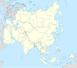
| Coordinates: 26°03′N 74°01′E / 26.05°N 74.02°E | |
| Country | |
| State | Rajasthan |
| District | Beawar |
| Talukas | Raipur |
| Government | |
| • Body | Raipur Gram Panchayat |
| Population (2011) | |
• Total | 12,157 |
| Languages | |
| • Official | Hindi, Marwari |
| Time zone | UTC+5:30 (IST) |
| PIN | 306304 |
| Telephone code | 02937 |
| ISO 3166 code | RJ-IN |
| Vehicle registration | RJ-22 |
| Sex ratio | 964 ♂/♀ |
| Lok Sabha constituency | Pali |
| Vidhan Sabha constituency | Raipur |
| Civic agency | Raipur Gram Panchayat |
| Avg. annual temperature | 30 °C (86 °F) |
| Avg. summer temperature | 44 °C (111 °F) |
| Avg. winter temperature | 05 °C (41 °F) |
Raipur is a village in the Beawar district of the Indian state of Rajasthan, as well as the Tehsil headquarters. It is situated on the banks of the Luni river, and is locally famous for its Ganesha temple. There is a famous Ramdwara of Ramsnehi Sampradya.
Demographics
[edit]The population of Raipur is 14,136 according to the 2001 census, with 7,198 males compared to 6,938 females. Raipur is situated on Ahmedabad-Delhi national highway. Raipur has many historical places which have become a center of attraction for tourists.


