River Nile State
Appearance
This article needs additional citations for verification. (December 2009) |
River Nile State
ولاية نهر النيل | |
|---|---|
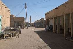
 Market street in Ad-Damir | |
 Location in Sudan. | |
| Coordinates: 18°27′N 33°23′E / 18.450°N 33.383°E | |
| Country | |
| Capital | Ad-Damir |
| Area | |
• Total | 122,123 km2 (47,152 sq mi) |
| Population (2018) | |
• Total | 1,511,442[1] |
| Time zone | UTC+2 (CAT) |
| HDI (2017) | 0.602[2] medium · 3rd |
River Nile State (Arabic: ولاية نهر النيل, romanized: Nahr an Nīl) is one of the 18 wilayat or states of Sudan. It has an area of 122,123 km² (47,152 mi²) and an estimated population of 1,511,442 (2018 est).[3] It is made up of seven localities.[4]
Localities
[edit]- Ad-Damir (Capital)
- Atbara
- Shendi
- Berber
- Abu Hamed
- El Matamah
- El Buhaira
References
[edit]- ^ "Archived copy" (PDF). Archived from the original (PDF) on 2017-03-12. Retrieved 2017-08-06.
{{cite web}}: CS1 maint: archived copy as title (link) - ^ "Sub-national HDI - Area Database - Global Data Lab". hdi.globaldatalab.org. Retrieved 2018-09-13.
- ^ "Archived copy" (PDF). Archived from the original (PDF) on 2017-03-12. Retrieved 2023-06-09.
{{cite web}}: CS1 maint: archived copy as title (link) - ^ "ولاية نهر النيل » رئاسة الجمهورية - القصر الجمهوري" [State of River Nile » Sudanese Presidency » Republican Palace] (in Arabic). Presidency of Sudan. Retrieved 29 December 2021.
External links
[edit]- en.nahralnileinvest.gov.sd, Ministry of Investment, Industry, Tourism & Mining River Nile State

