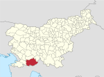
Koseze, Ilirska Bistrica
Appearance
Koseze | |
|---|---|
| Coordinates: 45°33′9.46″N 14°14′30.3″E / 45.5526278°N 14.241750°E | |
| Country | |
| Traditional region | Inner Carniola |
| Statistical region | Littoral–Inner Carniola |
| Municipality | Ilirska Bistrica |
| Area | |
• Total | 2.17 km2 (0.84 sq mi) |
| Elevation | 405.9 m (1,331.7 ft) |
| Population (2002) | |
• Total | 371 |
| [1] | |
Koseze (pronounced [kɔˈseːzɛ]; German: Kosese,[2] Italian: Cossese) is a settlement on the left bank of the Reka River southwest of Ilirska Bistrica in the Inner Carniola region of Slovenia.[3]
History
[edit]During the short ten-day Slovene Independence War in 1991, Yugoslav and Slovene troops met in a small engagement ending with a handful of casualties in the village of Koseze.[4]
Church
[edit]The small church in the settlement is dedicated to Mary Magdalene and belongs to the Parish of Ilirska Bistrica.[5]
References
[edit]- ^ Statistical Office of the Republic of Slovenia
- ^ Leksikon občin kraljestev in dežel zastopanih v državnem zboru, vol. 6: Kranjsko. 1906. Vienna: C. Kr. Dvorna in Državna Tiskarna, p. 134.
- ^ Ilirska Bistrica municipal site
- ^ Švajncer, Janez J. (2000). "Vojna za Slovenijo 1991". Enciklopedija Slovenije (in Slovenian). Vol. 14 (U-We). Ljubljana: Mladinska knjiga. p. 323. ISBN 86-11-14288-8.
- ^ Koper Diocese list of churches Archived 2009-03-06 at the Wayback Machine
External links
[edit]


