Ochi (mountain)
Appearance
You can help expand this article with text translated from the corresponding article in Greek. (October 2022) Click [show] for important translation instructions.
|
| Ochi | |
|---|---|
| Όχη | |
southeastern Euboea | |
| Highest point | |
| Elevation | 1,398 m (4,587 ft)[1] |
| Coordinates | 38°03′35″N 24°28′00″E / 38.0598°N 24.4668°E |
| Naming | |
| Pronunciation | Greek: [ˈoçi] |
| Geography | |
| Location | southeastern Euboea |
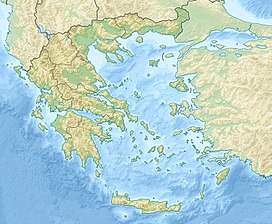
Ochi (Greek: Όχη; Latin: Oche mons) is a mountain in the southeasternmost part of the island of Euboea, Greece. Its maximum elevation is 1,398 m.[1] While most of the mountain range is covered with grassland and bushes, there are forests on the northern slopes. It is 6 km northeast of the coastal town of Karystos, 90 km southeast of the island capital Chalcis and 65 km east of Athens.
See also
[edit]References
[edit]- ^ a b Oreivatein.com

