Seliatyn
Appearance
Selyatin
Селятин Seletin (in Romanian) | |
|---|---|
 | |
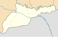
Location in Chernivtsi Oblast | |
| Coordinates: 47°52′25″N 25°11′10″E / 47.87361°N 25.18611°E | |
| Country | |
| Oblast | |
| Raion | Vyzhnytsia Raion |
| Elevation | 628 m (2,060 ft) |
| Population (2021) | |
• Total | 2,380 |
| Time zone | UTC+2 (EET) |
| • Summer (DST) | UTC+3 (EEST) |
| Postal code | 59131 |
| Area code | +380 738 |
 | |
Selyatyn (Ukrainian: Селятин; Romanian: Seletin) is a village in Vyzhnytsia Raion, Chernivtsi Oblast, Ukraine. It hosts the administration of Seliatyn rural hromada, one of the hromadas of Ukraine.[2]
Until 18 July 2020, Seliatyn belonged to Putyla Raion. The raion was abolished in July 2020 as part of the administrative reform of Ukraine, which reduced the number of raions of Chernivtsi Oblast to three. The area of Putyla Raion was merged into Vyzhnytsia Raion.[3][4]
Geography
[edit]Climate
[edit]| Climate data for Seliatyn (1981–2010) | |||||||||||||
|---|---|---|---|---|---|---|---|---|---|---|---|---|---|
| Month | Jan | Feb | Mar | Apr | May | Jun | Jul | Aug | Sep | Oct | Nov | Dec | Year |
| Mean daily maximum °C (°F) | 0.5 (32.9) |
2.1 (35.8) |
5.9 (42.6) |
11.8 (53.2) |
17.7 (63.9) |
20.5 (68.9) |
22.4 (72.3) |
22.2 (72.0) |
17.6 (63.7) |
13.0 (55.4) |
6.5 (43.7) |
1.5 (34.7) |
11.8 (53.2) |
| Daily mean °C (°F) | −5.7 (21.7) |
−4.5 (23.9) |
−0.5 (31.1) |
5.1 (41.2) |
10.7 (51.3) |
13.8 (56.8) |
15.7 (60.3) |
15.1 (59.2) |
10.5 (50.9) |
5.7 (42.3) |
−0.1 (31.8) |
−4.3 (24.3) |
5.1 (41.2) |
| Mean daily minimum °C (°F) | −10.8 (12.6) |
−9.8 (14.4) |
−5.6 (21.9) |
−0.3 (31.5) |
4.5 (40.1) |
7.9 (46.2) |
9.8 (49.6) |
9.3 (48.7) |
5.1 (41.2) |
0.5 (32.9) |
−4.8 (23.4) |
−8.9 (16.0) |
−0.3 (31.5) |
| Average precipitation mm (inches) | 29.5 (1.16) |
33.4 (1.31) |
44.3 (1.74) |
62.2 (2.45) |
103.0 (4.06) |
129.4 (5.09) |
143.2 (5.64) |
114.9 (4.52) |
73.0 (2.87) |
47.0 (1.85) |
36.6 (1.44) |
34.7 (1.37) |
851.2 (33.51) |
| Average precipitation days (≥ 1.0 mm) | 7.9 | 8.0 | 10.0 | 10.9 | 13.2 | 14.9 | 14.1 | 12.0 | 9.3 | 8.5 | 7.3 | 8.5 | 124.6 |
| Average relative humidity (%) | 80.8 | 81.6 | 80.6 | 79.3 | 77.2 | 78.5 | 78.5 | 79.8 | 81.2 | 82.4 | 84.7 | 85.9 | 80.9 |
| Source: World Meteorological Organization[5] | |||||||||||||
References
[edit]- ^ "Selyatin (Chernivtsi Oblast, Putyla Raion)". weather.in.ua. Retrieved 8 February 2023.
- ^ "Селятинская громада" (in Russian). Портал об'єднаних громад України.
- ^ "Про утворення та ліквідацію районів. Постанова Верховної Ради України № 807-ІХ". Голос України (in Ukrainian). 2020-07-18. Retrieved 2020-10-03.
- ^ "Нові райони: карти + склад" (in Ukrainian). Міністерство розвитку громад та територій України.
- ^ "World Meteorological Organization Climate Normals for 1981–2010". World Meteorological Organization. Archived from the original on 17 July 2021. Retrieved 17 July 2021.


