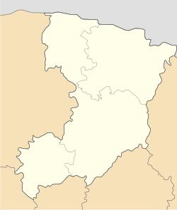
Haiky-Sytenski
Haiky-Sytenski
Гайки-Ситенські | |
|---|---|
Village | |
| Coordinates: 50°9′55″N 25°26′20″E / 50.16528°N 25.43889°E | |
| Country | Ukraine |
| Oblast | Rivne Oblast |
| Raion | Dubno Raion |
| Hromada | Krupets rural hromada |
| Founded | 1639[1] |
| Population | |
• Total | 423 |
| Time zone | UTC+2 (EET) |
| • Summer (DST) | UTC+3 (EEST) |
| Area code | +380 3633 |
| Website | rada |
Haiky-Sytenski (Ukrainian: Гайки-Ситенські) is a village in western Ukraine. It is in Dubno Raion in Rivne Oblast. It belongs to Krupets rural hromada, one of the hromadas of Ukraine.[2] It has population of 423.[3]
History
[edit]In 1906 settlement was a Khutor in Krupets Volost Dubensky Uyezd Volhynian Governorate. It was located 10 verst from Krupets and 41 verst from Dubno. It included 53 homesteads and 328 residents.[4]
Until 12 June 2020, Haiky-Sytenski belonged to Radyvyliv Raion. The raion was abolished that day as part of the administrative reform of Ukraine.[5]
On 17 July 2020, village was again transferred to Dubno Raion as Radyvyliv Raion was abolished.[6]
Demographics
[edit]In 2001 the settlement had 487 inhabitants. Native language as of the Ukrainian Census of 2001:[7]
- Ukrainian - 99.18%
- Russian& - 0.82%
People
[edit]- Volodymyr Lemeshchuk (1998–2022), a Ukrainian Captain killed in the Russo-Ukrainian War.[8]
- Ivan Lemeshchuk (1993-2014), a Ukrainian soldier killed in the Russo-Ukrainian War.
References
[edit]- ^ "Село Гайки-Ситенські" [Village Haiky-Sytenski]. mistaua.com (in Ukrainian). Retrieved 15 February 2023.
- ^ "Крупецька громада" [Krupets hromada]. gromada.info (in Ukrainian). Retrieved 7 February 2023.
- ^ "Населені пункти у підпорядкуванні ОТГ: Крупецька громада" [Settlements under the jurisdiction of the OTG: Krupets hromada]. Krupets hromada (in Ukrainian). Retrieved 15 February 2023.
- ^ Volhynian Governorate Statistical Committee (1906). Список населенных мест Волынской губернии [List of populated places of Volhynian Governorate] (PDF) (in Russian). Zhytomyr: Volhynian Governorate Typography. p. 53. Archived from the original (PDF) on 14 December 2017. Retrieved 15 February 2023.
- ^ Laws of Ukraine. Government of Ukraine No. 722-2020-р: Про визначення адміністративних центрів та затвердження територій територіальних громад Рівненської області [About defining administrative centers and approving territories of territorial hromadas of Rivne Oblast]. Adopted on 12 June 2020. (Ukrainian)
- ^ Laws of Ukraine. Verkhovna Rada No. 807-IX: Про утворення та ліквідацію районів [About the formation and liquidation of districts]. Adopted on 17 July 2020. (Ukrainian)
- ^ "Databank of State Statistics Service of Ukraine". ukrcensus.gov.ua. Retrieved 14 February 2023.
- ^ "27 квітня 2022 року - в Крупецькій територіальній громаді день жалоби" [April 27, 2022 April 27, 2022 - a day of mourning in the Krupetsk territorial community - a day of mourning in the Krupetsk territorial community]. krupetska-gromada.gov.ua (in Ukrainian). 27 April 2022. Retrieved 12 February 2023.


