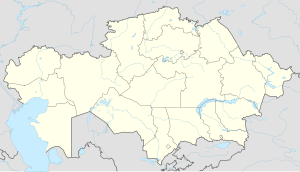
Pogranichnik (Pavlodar Region)
Appearance
Pogranichnik
Пограничник | |
|---|---|
Village | |
| Coordinates: 52°06′32″N 76°24′21″E / 52.10889°N 76.40583°E | |
| Country | Kazakhstan |
| Region | Pavlodar Region |
| City administration | Aksu City Administration |
| Established | 1954 |
| Population (2021) | |
• Total | 939 |
| Time zone | UTC+6 (Omsk Time) |
| Postcode | 140115 |
Pogranichnik (Kazakh: Пограничник), formerly Barlykbay, is a village in the Aksu City Administration, Pavlodar Region, Kazakhstan. It is part of Dostyk Rural District (KATO code - 551665100).[1] Population: 994 (2009 Census results);[2] 1,170 (1999 Census results).[2][3]
Geography
[edit]Pogranichnik is located 35 km (22 mi) to the WNW of Aksu City and 26 km (16 mi) to the northeast of Kalkaman. The village lies near lakes Sarykol and Uzynbulak, close to the northwestern end of lake Kalkaman. The Ekibastuz - Pavlodar highway passes by Pogranichnik.[4][5]
References
[edit]- ^ "База КАТО". Агентство Республики Казахстан по статистике. Archived from the original on 2013-09-27.
- ^ a b "Население Республики Казахстан" [Population of the Republic of Kazakhstan] (in Russian). Департамент социальной и демографической статистики. Retrieved 8 December 2013.
- ^ "Итоги Национальной переписи населения Республики Казахстан 2009 года" (PDF). Агентство Республики Казахстан по статистике. Archived from the original (PDF) on 2013-05-13.
- ^ "M-43 Topographic Chart (in Russian)". Retrieved 13 April 2024.
- ^ Google Earth.


