Jump to content

Hope Reef

Coordinates: 35°12′48.1″S 174°14′47.0″E / 35.213361°S 174.246389°E / -35.213361; 174.246389
From Wikipedia, the free encyclopedia

This is the current revision of this page, as edited by Petersmeter (talk | contribs) at 10:22, 15 November 2024 (Created page with '{{short description|Small island in New Zealand}} {{Use New Zealand English|date=November 2024}} {{Use dmy dates|date=November 2024}} {{Infobox islands | name = Hope Reef | local_name = | image_name = | image_caption = | locator_map = | map_caption = | nickname = | location = Bay of Islands | coordinates = {{coord|35|12|48.1|S|174|14|47.0|E|region:NZ_type:isle_scale:500000|display=inline,titl...'). The present address (URL) is a permanent link to this version.

(diff) ← Previous revision | Latest revision (diff) | Newer revision → (diff)

Hope Reef
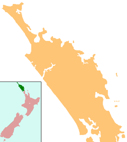
Hope Reef is located in Northland Region
Hope Reef
Hope Reef
Geography
LocationBay of Islands
Coordinates35°12′48.1″S 174°14′47.0″E / 35.213361°S 174.246389°E / -35.213361; 174.246389
Administration
New Zealand

Hope Reef is a small island in the Bay of Islands of New Zealand, located about 12 kilometres (7.5 mi) northeast of Russell.[1] It is situated about 528 metres (1,732 ft) off Urupukapuka Island and is only visible above water at low tide.

Hope Reef is a popular intermediate dive spot with a chance of spotting kingfish and a scallop bed.[2]

References

[edit]
  1. ^ "Hope Reef, Northland – NZ Topo Map". Land Information New Zealand. Retrieved 6 November 2024.
  2. ^ "Dive Destination: Bay of Islands". Dive Pacific. Retrieved 15 November 2024.