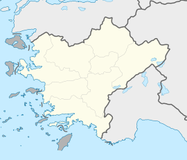
Turgutreis
Turgutreis | |
|---|---|
 | |
| Coordinates: 37°01′N 27°16′E / 37.017°N 27.267°E | |
| Country | Turkey |
| Province | Muğla |
| District | Bodrum |
| Population (2022) | 6,041 |
| Time zone | UTC+3 (TRT) |
| Postal code | 48400 |
| Area code | 0252 |
Turgutreis is a neighbourhood of the municipality and district of Bodrum, Muğla Province, Turkey.[1] Its population is 6,041 (2022).[2] Before the 2013 reorganisation, it was a town (belde).[3][4] It is the second largest town on the Bodrum peninsula. The town is a popular holiday destination with 5 kilometres of sandy beaches, waterfront restaurants and bars, and is considered a resort town.
The town is named after the Ottoman admiral Turgut Reis who was born there in 1485.[5] Also known as Dragut, Turgut Reis was famous for his expeditions on the coasts of Spain, France, Italy, and North Africa, and for his participation in the Ottoman siege of Malta, in which he was killed. There is a memorial to Turgut Reis a few kilometres from the town centre located in Sabanci Park.[citation needed] The town was formerly named Karatoprak before being renamed in Turgut Reis's honour in 1972.[6]
The coastline consists of several inlets, with steep mountains running parallel to the coast. There are 14 Turkish islets around Turgutreis including Küçük Kiremit, Büyük, Fener, Çatal, Yassı, Tüllüce, Kargı, Köçek, Kadıkalesi, and Sarıat, as well as the bigger Greek islands of Kos and Kalimnos. The town has a marina which provides access to the nearby Greek island of Kos via ferry.
Famous residents
[edit]See also
[edit]- Tourism in Turkey
- Turkish Riviera
- Blue Cruise
- Marinas in Turkey
- Foreign purchases of real estate in Turkey
References
[edit]- ^ Mahalle, Turkey Civil Administration Departments Inventory. Retrieved 19 September 2023.
- ^ "Address-based population registration system (ADNKS) results dated 31 December 2022, Favorite Reports" (XLS). TÜİK. Retrieved 19 September 2023.
- ^ "Law No. 6360". Official Gazette (in Turkish). 6 December 2012.
- ^ "Classification tables of municipalities and their affiliates and local administrative units" (DOC). Official Gazette (in Turkish). 12 September 2010.
- ^ Reynolds, Clark G. (1974). Command of the sea: the history and strategy of maritime empires. Morrow. pp. 120–121. ISBN 9780688002671.
Ottomans extended their western maritime frontier across North Africa under the naval command of another Greek Moslem, Torghoud (or Dragut), who succeeded Barbarossa upon the latter's death in 1546.
- ^ Karar Sayısı: 7/3659, Resmî Gazete, 11 February 1972.
External links
[edit] Bodrum travel guide from Wikivoyage
- Bodrum City Guide
- Pictures of Turgutreis
- Sun City Turgutreis
Gallery
[edit]-
A fiery sunset taken in Turgutreis, Turkey
-
Golden sunset taken in Turgutreis, Turkey
-
Golden sunset taken in Turgutreis, Turkey
-
Golden sunset taken in Turgutreis, Turkey
-
A nighttime view of the Turgutreis sky and its many constellations, away from urban light pollution. Nebulas and deep sky objects are also slightly visible.


