Witham Charterhouse
| Witham Charterhouse | |
|---|---|
 Parish church of the Blessed Virgin Mary, St John Baptist and All Saints, Witham Friary, formerly lay brothers' church of the Charterhouse | |
| Religion | |
| Affiliation | Carthusian |
| Year consecrated | 1178/1179 |
| Status | abandoned |
| Location | |
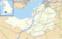
| Location | Witham Friary, Somerset, England |
| Geographic coordinates | 51°09′47″N 2°21′58″W / 51.1631°N 2.3660°W |
Witham Charterhouse, also Witham Priory, at Witham Friary, Somerset, was established in 1178/79, the earliest of the ten medieval Carthusian houses (charterhouses) in England. It was suppressed in the Dissolution of the Monasteries in 1539.
History
[edit]The charterhouse was founded by Henry II in his Royal Forest of Selwood, as part of his penance for the murder of Archbishop Thomas Becket of Canterbury and was established at Witham Friary, Somerset, in 1178/1179 by a founding party led by a monk called Narbert from the Grande Chartreuse. Hugh of Avalon (later Saint Hugh) was made prior of Witham Charterhouse in 1180.[1]
The house was suppressed as part of the dissolution of the monasteries on 15 March 1539.[1]
The lay brothers' church is now used as the parish church of Witham Friary.
Archaeology
[edit]In 1921 excavations revealed buttressed wall foundations and building rubble including glazed roof tiles and floor tiles. Later work in 1965 and 1968 revealed further buildings, two of which were interpreted as the chapter house and possibly a church.[2]
Remains
[edit]
The site of the charterhouse is marked by extensive rectilinear earthworks, cut by a railway line, and some worked stone can still be seen in buildings in the village of Witham Friary. The remains of the original monastic fishponds still survive to the east of the site.[2]
References
[edit]- ^ a b Coppack, Glyn; Aston, Mick (2002). Christ's Poor men - the Carthusians in England. Tempus. ISBN 0-7524-1961-7.
- ^ a b Firth, Hannah. Mendip from the air: A changing landscape. Somerset Heritage Series. Taunton Castle: Somerset County Council. ISBN 978-0-86183-390-0.
- Archaeological sites in Somerset
- Buildings and structures in Mendip District
- Carthusian monasteries in England
- Christian monasteries established in the 1170s
- Church of England church buildings in Mendip District
- Monasteries dissolved under the English Reformation
- Monasteries in Somerset
- Ruined abbeys and monasteries
- Ruins in Somerset
- Scheduled monuments in Mendip District
- 1178 establishments in England
- 1539 disestablishments in England

