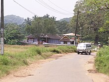
Muthuthala
Muthuthala
മുതുതല Muduthala | |
|---|---|
village | |
 Muthuthala Sree Maha Ganapathy Temple (2007) | |
 | |
| Coordinates: 10°47′N 76°10′E / 10.78°N 76.17°E | |
| Country | |
| State | Kerala |
| District | Palakkad |
| Government | |
| • Body | Muthuthala Panchayat |
| Population | |
• Total | 21,496 |
| Languages | |
| • Official | Malayalam, English |
| Time zone | UTC+5:30 (IST) |
| PIN | 679303 |
| Telephone code | 091-466 |
| Vehicle registration | KL-52 |
| Nearest city | Pattambi |
| Lok Sabha constituency | Palakkad |
| Civic agency | Muthuthala Panchayat |
| Climate | Humid (Köppen) |

Muthuthala is a village and gram panchayat.[1] It lies northwest of Pattambi in Palakkad district, of the state of Kerala, India. It is located on the banks of the Bharathapuzha River.
The infrastructure of the panchayath is divided into Kodumunda and Muthuthala. Muthuthala, Kodumunda and Karakkuth are important centres. The adjacent villages to Muthuthala are Pallippuram, Koppam and Pattambi.

Attractions
Muthuthala Temple
Muthuthala's notable attraction is the Muthuthala Maha Ganapathi Kshetram, or temple, enshrined with the idol of Maha Ganapathi as the principal deity. The other deities are Bhagavathy and Swami Ayyappan. . Many devotees from different parts of Kerala visit here to offer "Ottappam" or "Otta" offering a delicious sweet appam to the deity. This temple is also known for "Mangalya Puja" (special worship for removing any obstacles to the culmination of marriage). This ancient temple was renovated around the mid-2000’s. "Thalappoli" (a festival for the Kodikkunnu Bhagavathy presiding over here as well) is the main festival here in the Malayalam month of Makaram (February). There is a beautiful pond near the temple. The “Ambala Kulam (അമ്ബല കുളം)" (meaning Temple Pond in Malayalam) is blessed by the beauty of nature. A renovation of the pond was done in 2004. It is said that the pond contains 7 wells. Some of these wells have been damaged over the years.
History
There had been a trade link passing through the River Bharathapuzha. Varantakuttikkatavu was a ferry point which was connecting Thrithala, the local market place and Kodumunda, one of the market place in Muthuthala. Now there is no water transportation available by the coming of new roads. Small boats and rafts were once a major scene of this area.[clarification needed]
Demographics
As of 2001[update] India census, Muthuthala had a population of 21,496 with 10,297 males and 11,199 females.[2]
Transportation
Road
The village, located 8 km from Pattambi on the Pattambi-Pallippuram Road, can be reached by road and rail. The road from Pattambi forks in two directions at the Muthuthala junction. One road goes to Pallippuram and the other reaches the state highway to Perinthalmanna at Trithala Koppam junction. A diversion from Parakkad, a local village connects Perinthalmanna- Pattambi state highway at Sankaramangalam.
Rail
Kodumunda is the only railway station in Muthuthala, which is en route to Kozhikode on the Shoranur–Kozhikode railway line. Only a few passenger trains halt at this station, so the preferable means to reach Muthuthala is by road. Pattambi is the main railway station nearby where most of the trains do have a stopping.
Photos
-
Muthuthala Sree Maha Ganapathy Temple (2007)
-
Kodumunda is the only railway station in Muthuthala.
-
Muthuthala Sree Maha Ganapathy Temple (1984)
References
- ^ "Reports of National Panchayat Directory". Ministry of Panchayati Raj. Archived from the original on 2 January 2014. Retrieved 1 January 2014.
- ^ "Census of India : Villages with population 5000 & above". Registrar General & Census Commissioner, India. Retrieved 1 January 2014.


