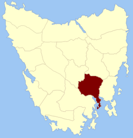
Monmouth Land District
Appearance
| Monmouth Error: unknown |state= value (help) | |||||||||||||||
|---|---|---|---|---|---|---|---|---|---|---|---|---|---|---|---|
 Location in Tasmania | |||||||||||||||
| LGA(s) | City of Clarence | ||||||||||||||
| |||||||||||||||
Error: |type= not defined (help) | |||||||||||||||

Monmouth Land District is one of the twenty land districts of Tasmania which are part of the Cadastral divisions of Tasmania. It was formerly one of the 18 counties of Tasmania. It is bordered by the Derwent River to the south, the Clyde River to the west, and a small part of the Jordan River to the north.
It includes the parts of Greater Hobart which are located to the east of the Derwent, such as Rosny Park and Bridgewater. It also includes Kempton and Hamilton.
