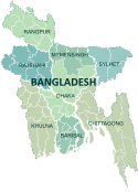
Sunamganj District
Template:Infobox of BD districts
Sunamganj is a district in north-eastern Bangladesh. It is a part of the Sylhet administrative division.
Geography
Sunamganj is in Sylhet and is six miles away from India. The rivers Surma River & Kushiyara River runs through it.
Annual average temperature: maximum 33.2°C and minimum 13.6°C; annual rainfall 3334 mm. There are many haors and beels in Sunamganj.
People and population
Sunamgonj has a population of 1968669; male 50.89%, female 49.11%.
Religious context is Muslim 83.62%, Hindu 15.95%, others 0.43%
There are also some 6,643 ethnic nationals of Manipuri, Khasia, Garo and Hajong from the nearby neighbouring countries.
History
Not a lot is known about Sunamganj's history.
In 1336 BS a devastating flood occurred as a result of breaking down a damn in Manipur. This flood is popularly known as 'White Water Flood'. A pernicious earthquake on 12 June 1897 caused heavy loss of lives and establishments.
However the Nankar Rebellion of Sukhair in 1922-23 is notable. Many political leaders and activists of Sunamganj were involved in the anti-British movement. The leftist movement spread over the district after the partition of 1947.
During the war of liberation many encounters were held between the freedom fighters and the Pakistani Army. Sunamganj was liberated on 6 December 1971.
Education
Subdivisions
Sunamganj District is comprised of 10 sub-districts or Upazilas.
They are:
- Bishwamvarpur
- Chhatak
- Derai
- Dharampasha
- Dowarabazar
- Jagannathpur
- Jamalganj
- Sullah
- Sunamganj
- Tahirpur
- httt://mnalamfarid.com
- http://www.sunamganj.co.uk
- http://www.sunamganj.com

