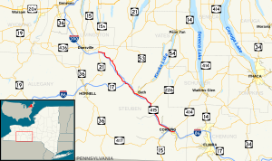
New York State Route 415
Appearance
 | ||||
| Route information | ||||
| Maintained by NYSDOT | ||||
| Length | 42.83 mi[1] (68.93 km) | |||
| Existed | 1974–present | |||
| Location | ||||
| Country | United States | |||
| State | New York | |||
| Counties | Steuben | |||
| Highway system | ||||
| ||||
New York State Route 415 is a state highway in the western part of New York, USA. NY 415 is a north-south trunk road that parallels in part, the Cohocton River, Interstate 86 and Interstate 390.
All of NY 415 from Painted Post west was once part of U.S. Route 15 until' it moved it's north termius at I-86 in Corning.
Major intersections
| County | Location | mi[2] | km | Destinations | Notes |
|---|---|---|---|---|---|
| Steuben | City of Corning | 0.00 | 0.00 | ||
| Painted Post | 3.14 | 5.05 | Exit 43 (I-86/NY 15/NY 17). | ||
| Campbell | 8.98 | 14.45 | Former | ||
| Savona | 13.98 | 22.50 | |||
| Village of Bath | 20.45 | 32.91 | Southern terminus of concurrency. | ||
| 21.20 | 34.12 | Northern terminus of concurrency. | |||
| Kanona | 24.02 | 38.66 | |||
| Cohocton | 36.03 | 57.98 | |||
| Wayland | 42.83 | 68.93 | |||
| 1.000 mi = 1.609 km; 1.000 km = 0.621 mi | |||||
References
- ^ New York Routes - New York State Route 415
- ^ "Traffic Data Report - NY 305 to NY 427" (PDF). NYSDOT. Retrieved 2007-07-07.

