Menlo Park, California
City of Menlo Park | |
|---|---|
 Location in San Mateo County and the state of California | |
| Country | United States |
| State | California |
| County | San Mateo |
| Incorporated | March 23, 1874 |
| Government | |
| • Mayor | Andrew M. Cohen |
| Area | |
• Total | 17.4 sq mi (45.1 km2) |
| • Land | 10.1 sq mi (12.7 km2) |
| • Water | 7.3 sq mi (18.9 km2) 41.88% |
| Elevation | 72 ft (22 m) |
| Population (2000 Census) | |
• Total | 30,785 |
| • Density | 3,040.1/sq mi (1,173.4/km2) |
| Time zone | UTC-8 (PST) |
| • Summer (DST) | UTC-7 (PDT) |
| ZIP codes | 94025-94029 |
| Area code | 650 |
| FIPS code | 06-46870 |
| GNIS feature ID | 1659108 |
| Website | http://www.menlopark.org/ |
Menlo Park is an affluent city in San Mateo County, California in the United States of America, in the San Francisco Bay Area. It is located at latitude 37°29' North, longitude 122°9' East. Menlo Park had 30,785 inhabitants as of the 2000 U.S. Census. It should be noted that the origin of the name of Menlo Park, California pre-dates (ca 1850)[1] any work done by Thomas Edison (ca 1876) in Menlo Park, New Jersey.
History
In the nineteenth century two Irish immigrants, Dennis J. Oliver and his brother-in-law D. C. McGlynn, purchased a 1,700-acre (6.9 km2) tract of land on the former Rancho de las Pulgas.[2] In the 1850s they erected a gate with a wooden arch bearing the inscription "Menlo Park", at the entrance to their property (now the intersection of Middle Ave and El Camino Real).[3][4] The word "Menlo" derived from the owners' former home of Menlough in County Galway, Ireland.[2] In 1863, the San Francisco and San Jose Rail Road named a nearby station "Menlo Park" after the sign.[2] The 1867 station building still stands on the platform of the current Caltrain station, used by the local Chamber of Commerce. The town of Menlo Park grew up around this station, becoming a popular home for San Francisco businessmen.[2] A post office arrived in 1870, and the city was incorporated in 1874.[3] The original arch which gave its name to the stations and ultimately the city survived until 1922, when it was destroyed in an automobile accident.[2]
Geography

Menlo Park is located at 37°27′15″N 122°10′43″W / 37.45417°N 122.17861°WInvalid arguments have been passed to the {{#coordinates:}} function (37.454188, -122.178579).Template:GR
According to the United States Census Bureau, the city has a total area of 17.4 square miles (45.1 km²), of which 10.1 square miles (26.2 km²) is land and 7.3 square miles (18.9 km²) is water. The total area is 41.88% water.
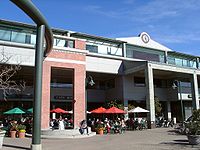
The main street in downtown Menlo Park is Santa Cruz Avenue, with the Menlo Center situated at its intersection with El Camino Real. The Menlo Park Civic Center is bounded by Ravenswood Avenue, Alma Street, Laurel Street and Burgess Drive. It contains the council offices, library, police station and Burgess Park which has various recreational facilities.
Although Menlo Park is mainly upper middle-class, the northern section of Menlo Park highly resembles North Fair Oaks and East Palo Alto in demographic make-up and income level.
Demographics

As of the censusTemplate:GR of 2000, there were 30,785 people, 12,387 households, and 7,122 families residing in the city. The population density was 3,040.1 people per square mile (1,173.4/km²). There were 12,714 housing units at an average density of 1,255.5/sq mi (484.6/km²). The racial makeup of the city was 68.35% White, 9.03% African American, 0.54% Native American, 6.15% Asian, 1.46% Pacific Islander, 9.56% from other races, and 4.21% from two or more races. Hispanic or Latino of any race were 19.60% of the population.
There were 12,387 households out of which 26.6% had children under the age of 18 living with them, 46.3% were married couples living together, 8.5% had a female householder with no husband present, and 42.5% were non-families. 32.1% of all households were made up of individuals and 11.4% had someone living alone who was 65 years of age or older. The average household size was 2.41 and the average family size was 3.12.
In the city the population was spread out with 21.9% under the age of 18, 6.2% from 18 to 24, 34.7% from 25 to 44, 21.4% from 45 to 64, and 15.9% who were 65 years of age or older. The median age was 37 years. For every 100 females there were 94.0 males. For every 100 females age 18 and over, there were 90.6 males.
The median income for a household in the city was $84,609, and the median income for a family was $105,550. Males had a median income of $79,766 versus $51,101 for females. The per capita income for the city was $53,341. About 4.2% of families and 6.9% of the population were below the poverty line, including 8.8% of those under age 18 and 7.3% of those over age 64.
Politics
In the state legislature Menlo Park is located in the 11th Senate District, represented by Democrat Joe Simitian, and in the 21st Assembly District, represented by Democrat Ira Ruskin. Federally, Menlo Park is located in California's 14th congressional district, which has a Cook PVI of D +18[5] and is represented by Democrat Anna Eshoo.
Features

- Home to the Western Region Geography office of the United States Geological Survey.
- Sand Hill Road, location of many Silicon Valley venture capital firms.
- Home to SRI International, formerly Stanford Research Institute.
- Home to the Stanford Linear Accelerator Center.
- Corporate offices and show gardens of Sunset Magazine.
- Google Inc. was founded here on September 7, 1998
- Adjacent to Stanford University and Stanford Shopping Center.
- Home to Saint Patrick Archdiocesan Seminary and University.
- Home to Fuller Northern California
- Home to Geron Corporation, a biotechnology company focusing on telomere and stem cell research.
- Home to the original store of the Round Table Pizza chain.
Historic Landmarks

California Historical Landmarks
- Campsite and terminus point of the de Portolá Expedition from November 6, 1796 through November 10, 1796.
- Home to the oldest continually operating train station in California, making it State Historical Landmark #955.
- Twentieth Century Folk Art Environments, State Historical Landmark #939.
National Historical Landmarks National Register of Historic Places lists:
- Barron--Latham--Hopkins Gate Lodge #8600195
- Church of the Nativity (Menlo Park, California) #80000855
- Menlo Park Railroad Station #74000556
- Rock Magnetics Laboratory(USGS) #94001647.
Famous residents
- Sergey Brin (Google, 1973–)
- Lindsey Buckingham (musician, 1949–)
- Henry Cowell (composer, 1897–1965)
- Emily Louanne Rose (debutante, 1983–)
- Jeanne DuPrau an author whose books are typically geared towards preteens and teenagers.
- Nancy Farmer (author)
- Merle "Hap" Johnson (decorated World War II colonel shot down in France; led men to safety in Spain across the Pyrenees, 1918–2007)
- Phar Lap (New Zealand racehorse)
- Milton Latham (railroad baron/politician/California Governor (shortest term - 5 days)
- Josie Maran (model, 1978–)
- Stevie Nicks (musician, 1948–)
- Courtney Thorne-Smith (actress, 1967–)
- Joan Baez, folk singer
- John Vesely, singer-songwriter of Secondhand Serenade (musician)
- Vince Guaraldi
- Stan Getz (American jazz saxophone player)
- Isaac Baron (Professional poker player - Team Full Tilt Poker)
Traffic and parking
Menlo Park suffers from traffic congestion at peak use hours owing to its proximity to Stanford University, and its lack of high capacity arterials that connect Interstate 280 to U.S. Route 101. Much of the city's arterial network consists of two-lane roads. The city analyzed traffic impacts through the year 2010 in a study for its General Plan.[6] Traffic volumes were forecast to include all foreseeable traffic growth based upon Menlo Park and areawide land use forecasts. These data were utilized by the city to design roadway mitigation to minimize congestion. Sound levels were also assessed to understand the impacts to citywide ambient noise. Sound levels within 50 feet (15 m) of U.S. Route 101 were forecast to be 76 dBA Ldn, while levels of 73 dBA were forecast within comparable distances of El Camino Real; other noisiest arterials were Sand Hill Road and Willow Road, with levels expected up to 71 dBA.[7]
Menlo Park has a policy against parking on residential streets between 2 AM and 5 AM. This policy is enforced by the Menlo Park Police Department every night of the year. Each vehicle is allotted only one warning before being ticketed with a $35 fine. Residents may purchase annual parking permits if they live in certain apartment buildings within the city limits that lack adequate resident parking spaces and are zoned R3. All residents may purchase up to 50 one-night parking permits each six months for guests (guest permits cost $10 for a pack of 5 as of April 2005). Vehicles for the handicapped are exempt.
See also
Notes
- ^ Stanger, 1963. pg. 109
- ^ a b c d e
Hoover, Mildred Brooke (2002). Historic Spots in California (4th edition ed.). Stanford, CA: Stanford University Press. pp. p. 405. ISBN 0804744831.
{{cite book}}:|edition=has extra text (help);|pages=has extra text (help); Unknown parameter|coauthors=ignored (|author=suggested) (help) - ^ a b
Durham, David L (1998). California's Geographic Names: A Gazetteer of Historic and Modern Names of the State. Clovis, CA: Word Dancer Press. pp. p. 662. ISBN 1884995144.
{{cite book}}:|pages=has extra text (help) - ^ Stanger, 1963. pg. 109
- ^ "Will Gerrymandered Districts Stem the Wave of Voter Unrest?". Campaign Legal Center Blog. Retrieved 2008-02-10.
- ^ RKH, Civil and Transportation Engineering, Traffic Analysis for the City of Menlo Park Comprehensive Plan Amendment, Working Paper No. 6, (1989)
- ^ Earth Metrics Inc., Noise Impacts and Mitigation Measures for the Environmental Impact Report on the Revised Land Use and Circulation Elements, Menlo Park, California, submitted by the city of Menlo Park to the California State Clearinghouse, Document Number 7942.002, May 23, 1989
References
- Stanger, Frank M. South from San Francisco: The Life Story of San Mateo County 1963, publisher: San Mateo County Historical Association


