Stoneham, Massachusetts
Stoneham, Massachusetts | |
|---|---|
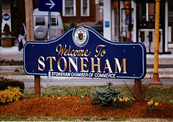
 Welcome to Stoneham Massachusetts | |
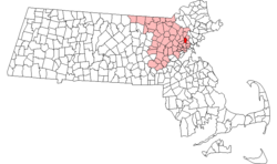
 Location in Middlesex County in Massachusetts | |
| Country | United States |
| State | Massachusetts |
| County | Middlesex |
| Settled | 1645 |
| Incorporated | 1725 |
| Government | |
| • Type | Open town meeting |
| Area | |
• Total | 6.7 sq mi (17.4 km2) |
| • Land | 6.2 sq mi (15.9 km2) |
| • Water | 0.6 sq mi (1.5 km2) |
| Elevation | 155 ft (47 m) |
| Population (2007) | |
• Total | 21,508 |
| • Density | 3,469.0/sq mi (1,352.7/km2) |
| Time zone | UTC-5 (Eastern) |
| • Summer (DST) | UTC-4 (Eastern) |
| ZIP code | 02180 |
| Area code | 339 / 781 |
| FIPS code | 25-67665 |
| GNIS feature ID | 0618235 |
| Website | http://www.ci.stoneham.ma.us |
Stoneham is a town in Middlesex County, Massachusetts, United States. The population was 22,219 at the 2000 census. Stoneham's postal ZIP code is 02180. rs.
History
The earliest mention of Stoneham by European settlers was in the year 1632 when Governor Winthrop and his party came upon this area to picnic. They found Spot Pond and ate their lunch on Cheese Rock, now known as Bear Hill. Stoneham was first settled in 1645 and was originally a part of Charlestown; the original settlers of the area were Whigs. In 1725, the residents of the area petitioned Charlestown to allow them to form a separate town, although no specific reason was given for why they did this. When Stoneham was officially incorporated that year, the taxable male population was 65. Stoneham remained a small town during the colonial era. However, during the Industrial Revolution, Stoneham prospered as a major shoe-manufacturing center. In the 1970s, Stoneham was in the Guinness Book of World Records for having the greatest number of gas stations along a one-mile strip.
Geography
Stoneham is located at 42°28′48″N 71°5′54″W / 42.48000°N 71.09833°WInvalid arguments have been passed to the {{#coordinates:}} function (42.480145, -71.098352).Template:GR
According to the United States Census Bureau, the town has a total area of 6.7 square miles (17.4 km²), of which, 6.2 square miles (15.9 km²) of it is land and 0.6 square miles (1.5 km²) of it (8.36%) is water.
Stoneham borders the following towns: Woburn, Winchester, Medford, Malden, Melrose, Wakefield, and Reading.
Demographics
As of the censusTemplate:GR of 2000, there were 22,219 people, 9,050 households, and 5,873 families residing in the town. The population density was 3,614.1 people per square mile (1,394.9/km²). There were 9,289 housing units at an average density of 1,510.9/sq mi (583.2/km²). The racial makeup of the town was 95.01% White, 0.89% Black or African American, 0.05% Native American, 2.61% Asian, 0.04% Pacific Islander, 0.59% from other races, and 0.90% from two or more races. Hispanic or Latino of any race were 1.79% of the population.
There were 9,050 households out of which 26.7% had children under the age of 18 living with them, 53.1% were married couples living together, 8.8% had a female householder with no husband present, and 35.1% were non-families. 30.1% of all households were made up of individuals and 13.3% had someone living alone who was 65 years of age or older. The average household size was 2.42 and the average family size was 3.07.
In the town the population was spread out with 21.0% under the age of 18, 5.9% from 18 to 24, 30.4% from 25 to 44, 24.3% from 45 to 64, and 18.5% who were 65 years of age or older. The median age was 41 years. For every 100 females there were 89.0 males. For every 100 females age 18 and over, there were 85.6 males.
The median income for a household in the town was $56,605, and the median income for a family was $71,334. Males had a median income of $46,797 versus $37,274 for females. The per capita income for the town was $27,599. About 3.0% of families and 4.1% of the population were below the poverty line, including 5.7% of those under age 18 and 5.5% of those age 65 or over.
Notable residents
- Jonathan Goff: Linebacker for the New York Giants
- Marcos Valles: member of Boston rock band Parker House and Theory
- John Quigley:Acclaimed Artist & Illustrator
- Mario Cantone: comedian and actor
- Killer Kowalski: Former professional wrestler
- George J. Hall: U.S. Army soldier and Medal of Honor recipient in World War II
- Nancy Kerrigan: two-time Olympic figure skating medalist.
- Mike Ness: singer for punk band Social Distortion.
- Bill Peirce: Libertarian candidate for Governor of Ohio in 2006.
- Paul F. Perry: member of the a cappella singing group The Blanks, often featured on the television show Scrubs.
- John Rojak: Original member of the orchestra for Broadway’s Les Misérables and Bass trombonist for the American Brass Quintet.
- Joe Vitiello: former Major League Baseball player from 1995-2003; 1st round draft pick (7th overall) of the Kansas City Royals in 1991; played for the Royals, San Diego Padres, and Montreal Expos.
- Charles Gibbons : a Republican representative to the General Court of the Commonwealth of Massachusetts, who was later a Speaker of the Massachusetts House of Representatives and candidate for Governor.[1][2]
- Christopher Gardner : Eagle Scout and Lodge Chief of Moswetuset Lodge of the Order of the Arrow in the Boy Scouts of America. He also serves as the Section Secretary for Section NE-1A. Currently attends Tufts University. Installed twelve Automated External Defibrillators in the public schools to better prepare the town in case of an emergency. [3][4][5]
See also
References
- ^ The Political Graveyard: Index to Politicians: Gibbons
- ^ TIME
- ^ Moswetuset Lodge #52
- ^ [://www.stonehampublicschoolsfoundation.org Stoneham Public School Foundation]
- ^ Section NE-1A
Further reading

- History of Stoneham, Massachusetts by William Burnham Stevens, published 1891, 352 pages.
- History of Middlesex County, Massachusetts, Volume 1 (A-H), Volume 2 (L-W) compiled by Samuel Adams Drake, published 1879 and 1880. 572 and 505 pages. Stoneham article by Silas Dean in volume 2 pages 339-356.
- Vital Records of Stoneham, Massachusetts, to the End of the Year 1849 By Stoneham (Mass.), Essex Institute, published 1918.

