Burton, Ohio
Burton, Ohio | |
|---|---|
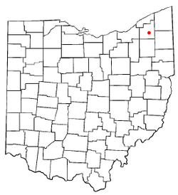
 Location of Burton, Ohio | |
| Country | United States |
| State | Ohio |
| County | Geauga |
| Government | |
| • Mayor | Thomas Blair Sr. |
| Area | |
• Total | 1.1 sq mi (2.9 km2) |
| • Land | 1.1 sq mi (2.9 km2) |
| • Water | 0.0 sq mi (0.0 km2) |
| Elevation | 1,316 ft (401 m) |
| Population (2000) | |
• Total | 1,450 |
| • Density | 1,308.1/sq mi (505.0/km2) |
| Time zone | UTC-5 (Eastern (EST)) |
| • Summer (DST) | UTC-4 (EDT) |
| ZIP code | 44021 |
| Area code | 440 |
| FIPS code | 39-10436Template:GR |
| GNIS feature ID | 1048570Template:GR |
| Website | http://www.burtonvillage.net/ |
Burton is a village in Geauga County, Ohio, United States. The population was 1,450 at the 2000 census.
History
Burton was founded in 1798 and is Geauga County's oldest settlement. Like many other early settlements in the Connecticut Western Reserve, Burton has a town square patterned after the village greens of New England.
Geography
Burton is located at 41°28′18″N 81°8′49″W / 41.47167°N 81.14694°WInvalid arguments have been passed to the {{#coordinates:}} function (41.471584, -81.146888)Template:GR.
According to the United States Census Bureau, the village has a total area of 1.1 square miles (2.9 km²), all of it land.
Demographics
As of the censusTemplate:GR of 2000, there were 1,450 people, 585 households, and 373 families residing in the village. The population density was 1,308.1 people per square mile (504.4/km²). There were 610 housing units at an average density of 550.3/sq mi (212.2/km²). The racial makeup of the village was 97.45% White, 0.69% African American, 0.21% Asian, 0.07% Pacific Islander, 0.14% from other races, and 1.45% from two or more races. Hispanic or Latino of any race were 0.90% of the population.
There were 585 households out of which 32.6% had children under the age of 18 living with them, 50.1% were married couples living together, 10.3% had a female householder with no husband present, and 36.1% were non-families. 32.0% of all households were made up of individuals and 10.6% had someone living alone who was 65 years of age or older. The average household size was 2.32 and the average family size was 2.94.
In the village the population was spread out with 23.3% under the age of 18, 7.9% from 18 to 24, 29.5% from 25 to 44, 21.7% from 45 to 64, and 17.6% who were 65 years of age or older. The median age was 38 years. For every 100 females there were 88.6 males. For every 100 females age 18 and over, there were 85.6 males.
The median income for a household in the village was $41,830, and the median income for a family was $51,250. Males had a median income of $35,417 versus $24,519 for females. The per capita income for the village was $19,516. About 5.4% of families and 7.2% of the population were below the poverty line, including 9.4% of those under age 18 and 5.5% of those age 65 or over.
Education
Local elementary and secondary public education is provided by the Berkshire Local School District, which also serves the surrounding communities of Burton Township, Claridon Township and Troy Township. The school district's one high school, Berkshire High School, is located just north of Burton's town square. The district's two elementary schools are located in Burton and Troy; The elementary school in Claridon Township closed in 2005. The Troy Elementary school was sold about year or two later but is still being used as a school.
Transportation
State highways
 Ohio State Route 87 traverses the village and encircles the town square.
 Ohio State Route 700 and
  Ohio State Route 168 become concurrent just south of the village and terminate at the junction of Ohio State Route 87 at the southern end of the town square.
References
External links
- Burton Village home page.
- Berkshire Local School District serves the village of Burton and the neighboring townships of Burton, Troy and Claridon.
- The Burton Public Library was founded in 1910 and is housed in the 1884 renovated schoolhouse.
- The Great Geauga County Fair is Ohio's oldest county fair.
- The Geauga County Historical Society's Century Village Museum.

