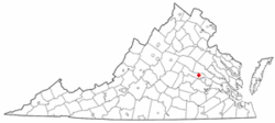
Short Pump, Virginia
Short Pump, Virginia | |
|---|---|
 Location of Short Pump, Virginia | |
| Country | United States |
| State | Virginia |
| County | Henrico |
| Area | |
• Total | 2.4 sq mi (6.2 km2) |
| • Land | 2.4 sq mi (6.1 km2) |
| • Water | 0.0 sq mi (0.0 km2) |
| Elevation | 312 ft (95 m) |
| Population (2000) | |
• Total | 182 |
| • Density | 76.7/sq mi (29.6/km2) |
| Time zone | UTC-5 (Eastern (EST)) |
| • Summer (DST) | UTC-4 (EDT) |
| FIPS code | 51-72272Template:GR |
| GNIS feature ID | 1495125Template:GR |

Short Pump is a census-designated place (CDP) in Henrico County, Virginia, United States. The population was 182 at the 2000 census.
Short Pump has greatly increased population in recent years, due to its proximity to Richmond. It has now become part of Richmond's Far West End. In 2003, developers opened Short Pump Town Center, a 1.2 million square foot open air shopping mall.
It is located in near many shopping centers, fast-food joints, and upscale restaurants. There is also a skating rink, bowling alley and many neighborhoods under development. There are also seven nearby schools: Short Pump Elementary School, Pocahontas Middle School, Short Pump Middle School, Byrd Middle School, Godwin High School and Deep Run High School.
Further growth is expected as increased development in West Creek Business Park in Goochland County, Virginia will bring increased population. Also, the construction underway of a high end mixed use West Broad Village will increase growth as well. The area is expected to receive two 13 story towers and a 10 story hotel.
Geography
Short Pump is located at 37°39′43″N 77°37′36″W / 37.66194°N 77.62667°WInvalid arguments have been passed to the {{#coordinates:}} function (37.661809, -77.626635)Template:GR.
According to the United States Census Bureau, the CDP has a total area of 2.4 square miles (6.2 km²), of which, 2.4 square miles (6.1 km²) of it is land and 0.42% is water.
Demographics
As of the censusTemplate:GR of 2000, there were 182 people, 69 households, and 44 families residing in the CDP. The population density was 76.7 people per square mile (29.6/km²). There were 77 housing units at an average density of 32.5/sq mi (12.5/km²). The racial makeup of the CDP was 91.76% White, 4.40% from other races, and 3.85% from two or more races. Hispanic or Latino of any race were 8.79% of the population.
There were 69 households out of which 31.9% had children under the age of 18 living with them, 52.2% were married couples living together, 10.1% had a female householder with no husband present, and 36.2% were non-families. 26.1% of all households were made up of individuals and 8.7% had someone living alone who was 65 years of age or older. The average household size was 2.64 and the average family size was 3.30.
In the CDP the population was spread out with 26.9% under the age of 18, 6.0% from 18 to 24, 33.5% from 25 to 44, 18.1% from 45 to 64, and 15.4% who were 65 years of age or older. The median age was 36 years. For every 100 females there were 106.8 males. For every 100 females age 18 and over, there were 107.8 males.
The median income for a household in the CDP was $60,531, and the median income for a family was $36,375. Males had a median income of $28,155 versus $26,250 for females. The per capita income for the CDP was $36,804. None of the population or families were below the poverty line.
Neighborhoods in Short Pump
Residents of Short Pump generally believe that the boundaries for Short Pump are Church Road, the Goochland County divide,and the bridge crossing over interstate 64. Short Pump is home to several individual neighborhoods. The major neighborhoods include:
- Glen Gary
- The Colonies
- Sherbrooke
- Wellesley
- Fox Hall
- Gayton Station
- Wythe Trace and Summerwood
- Barrington
- Barrington West
- Sterling
- Church Run
- Waterford
- Graham Meadows
- Twin Hickory
References

