Wikipedia:WikiProject Maps/Conventions/Area maps
This page provide conventions for wiki Areas maps.
Area maps displaying a multiple entities on a map, and are closely link to Historical maps which provide conventions for associated labels, icons, and legend. Historical label/icons conventions may also be used for other purpose, such complex biology maps, etc. This page conventions apply to areas. For further icons and legend conventions, see Historical maps conventions.
This Areas conventions are often use to display area of control by respective kingdoms/countries, plus some key points, and are actually the basis of more complex maps. You need this conventions when you start an explicative historical map. If you use these conventions to complete background such as topographic ones, apply a transparency of 30%.
Convention
The goal of a free, on-line encyclopedia is furthered when maps are properly designed with a clear, consistent look and feel. The following are the suggested standard colours for maps:
| Colour | Colorimetry ( hex / RGB ) | Used for | ||
|---|---|---|---|---|
L |
Black | #000000
R:0 G:0 B:0 |
Label colour | |
| Brown | #A08070
R:160 G:128 B:112 |
Political borders. Country, state, and province borders. | ||
| Light brown | #D0C0A0
R:208 G:192 B:160 |
Secondary political borders.[clarification needed] | ||
| Light yellow | #FFFFD0
R:255 G:255 B:208 |
Territory of interest (or one of four choices for four-colour maps). | ||
| Orange | #F7D3AA
R:247 G:211 B:170 |
Surrounding territories. | ||
| Medm blue | #9EC7F3
R:158 G:199 B:243 |
Bodies of water, oceans or lakes. | ||
| Blue | #1821DE
R:24 G:33 B:222 |
Lake or ocean's coasts, rivers, if necessary. | ||
| Red | #B00000
R:176 G:0 B:0 |
Point of interest (cities especially). | ||
| Red-orange | #F07568
R:240 G:117 B:104 |
Area of interest (animal' range, etc). | ||
| Medium red | #E0584E
R:224 G:88 B:78 |
Border colour for areas highlighted in Red-orange | ||
| Green | #A0F090
R:160 G:240 B:144 |
Parks or natural preservation areas | ||
| Light blue | #CEFEF2
R:206 G:254 B:242 |
An alternate color to be used[clarification needed] for four-colour maps. | ||
| Pink | #FFD0D0
R:255 G:208 B:208 |
Another colour to be used[clarification needed] for four-colour maps. | ||
| Orange | #F8A20C
R:248 G:162 B:12 |
A third colour to be used[clarification needed] for four-colour maps. | ||
| Green | #3CE67B
R:60 G:230 B:123 |
A fourth colour to be used[clarification needed] for four-colour maps. | ||
|
Naming (upload):
To find the subject name, use the wikipedia article's title, and if need, add just after the section's name, the year, etc. | ||||
Template
=> No SVG template available yet.
Gallery of examples
-
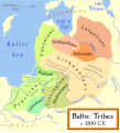
Map strictly respecting the Areas conventions.
-
Historical map, more free, but with colors close to the conventional ones.


