Rangamati
Appearance
- This article is about the city. For the district, see Rangamati District and Rangamati (2008 film).
Rangamati | |
|---|---|
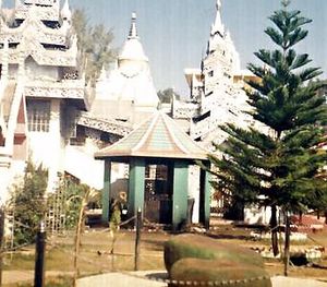
 The Temple of the Buddha at Rangamati | |
| Country | |
| Division | Chittagong Division |
| District | Rangamati District |
| Time zone | UTC+6 (Bangladesh Time) |
Rangamati is the principal city of Rangamati District in the Chittagong Hill Tracts of Bangladesh. The town is located at 22°37'60N 92°12'0E and has an altitude of 14 metres (49 feet).[1] In 2001 westerners working on a road project north of the town were kidnapped by tribal rebels, the kidnappers were renegade members of the Shanti Bahini who opposed the 1997 peace deal with the government.[2].
Notable landmarks


Prominent features include Mount Phuramon and the artificial Kaptai Lake. Also, Rangamati Government College.
References
Wikimedia Commons has media related to Rangamati.
