Romainville
Romainville | |
|---|---|
 | |
| Country | France |
| Arrondissement | Bobigny |
| Canton | Romainville |
| Government | |
| • Mayor | Corinne Valls |
| Population | 24,500 |
| Time zone | UTC+01:00 (CET) |
| • Summer (DST) | UTC+02:00 (CEST) |
| INSEE/Postal code | 93063 / |
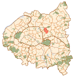
Romainville is a commune in the eastern suburbs of Paris, France. It is located 7.2 km (4.5 mi). (4.5 miles) from the center of Paris.
History
On July 24, 1867, a part of the territory of Romainville was detached and merged with a part of the territory of Pantin and a part of the territory of Bagnolet to create the commune of Les Lilas.
Transport
Romainville is served by no station of the Paris Métro, RER, or suburban rail network. The closest stations to Romainville are Mairie des Lilas station on Paris Métro Line 11 and Bobigny - Pantin - Raymond Queneau station on Paris Métro Line 5. The former is located in the neighboring commune of Les Lilas, 1.4 km (0.87 mi).(0.9 miles) from the town center of Romainville, and the latter is located in the neighboring commune of Pantin, 1.3 km (0.81 mi).(0.8 miles) from the town center of Romainville.
There are plans to extend Paris Métro Line 11 beyond its terminus at Mairie des Lilas station, reaching the town center of Romainville and beyond to Rosny-sous-Bois.
See also
References
- ^ 2005 estimate, 23,779 at the 1999 census
External links
- Official website (in French)

