Jump to content

User:Grunkhead/Hjálparfoss

Coordinates: 64°6′18″N 19°50′13″W / 64.10500°N 19.83694°W / 64.10500; -19.83694
From Wikipedia, the free encyclopedia

This is an old revision of this page, as edited by Grunkhead (talk | contribs) at 14:26, 16 May 2009 (Created page with 'thumb|Seljalandsfoss waterfall in Iceland. thumb|The trails behind the falls. [[Image:Seljalandsumme…'). The present address (URL) is a permanent link to this revision, which may differ significantly from the current revision.

(diff) ← Previous revision | Latest revision (diff) | Newer revision → (diff)
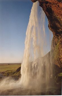
Seljalandsfoss waterfall in Iceland.
The trails behind the falls.
Seljalandsfoss at sunset. Near Hvolsvöllur in South Iceland.

Hjálparfoss is ...

one of the most famous waterfalls of Iceland. It is very picturesque and therefore its photo can be found in many books and calendars. It was a waypoint during the first leg of The Amazing Race 6.

Seljalandsfoss is situated in between Selfoss and Skógafoss at the road crossing of Route 1 (the Ring Road) with the track going into Þórsmörk.

This waterfall of the river Seljalandsá drops 60 metres (200 ft) over the cliffs of the former coastline. It is possible to go behind the waterfall.

See also

64°6′18″N 19°50′13″W / 64.10500°N 19.83694°W / 64.10500; -19.83694